Approximate Location Map
Large Map »
Latitude: 52.0036 / 52°0'13"N
Longitude: -3.2405 / 3°14'25"W
OS Eastings: 314938
OS Northings: 234636
OS Grid: SO149346
Mapcode National: GBR YW.HW9Y
Mapcode Global: VH6BN.SW6W
Plus Code: 9C4R2Q35+FQ
Entry Name: Keep at Bronllys Castle
Listing Date: 28 September 1961
Last Amended: 15 December 1995
Grade: I
Source: Cadw
Source ID: 6616
Building Class: Defence
Also known as: Castell Bronllys
ID on this website: 300006616
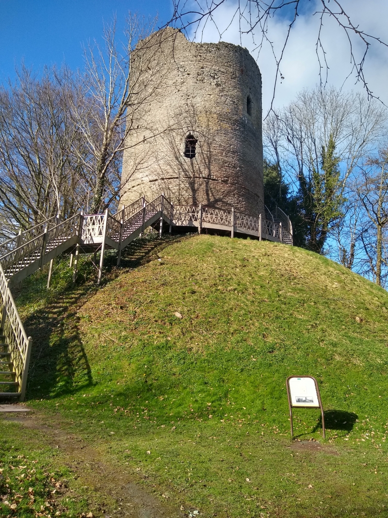
Location: Located strategically near the crossing of the Llynfi River, perched on a motte approximately 6m high
County: Powys
Community: Bronllys
Community: Bronllys
Traditional County: Brecknockshire
Tagged with: Castle Archaeological site
History: Bronllys Castle was located here to be near a palace or llys of the princes of Brycheiniog, thus both close to the seat of power and controlling the crossing of the River Llynfi. The present tower is the second rebuild in stone by Walter de Clifford II d1220, or III (1221-1263) of the original strong point of the castle of Richard Fitzpons of Clifford, originally erected c.1090-3 for his newly established capital for the cantref of Selyf, now only represented by the motte, with its extensive c.3 ha. inner and outer baileys lying to the N. A stone tower, probably a predecessor of the present one, was damaged by fire in 1175. The castle is believed to have been taken in 1262 and was again captured in 1322. The tower was later modified and was last fortified against the insurrection of Owain Glyndwr. The castle was at various times occupied by the Bohuns, Staffords, and the Crown, and was the home of Bedo Bruinllys the bard, the collector of the poems of Dafydd ap Gwillym. In 1521 it was reported by Leland as being beyond repair.
Description: Tightly laid laminated sandstone. No roof. Circular plan comprising 3 storeys and a basement within the apron splayed below a projecting string course, having 1 slit vent. Chamfered arched door on E, probably originally approached by an external wooden stair, leads to a circular chamber with 3 segmental tufa-arched embrasures equally spaced around circumference, that at SW with a window seat and stair to the 2nd floor. The embrasure on the NW is also seated and contains the stair to the vaulted basement. The windows are rebated internally for shutters, and secured by a draw bar. Sockets for ferrumenta and indications of a glazing check in the window head. Wall stair of 15 treads has two small lights. The first, solar, floor is now missing, but was carried on 12 bull-nosed corbels equally spaced around the wall. Seated embrasures on the S and E sides, with C14 ogee-headed foiled windows, also rebated for shutters, and a fireplace with depressed 2-centred chamfered arch on the W side, the hood lintel (missing) carried on finely carved brackets. Some plaster survives on S. From the E embrasure, a rebated stone frame for a door leads to a wall stair to the second floor, again also carried on 12 bullnosed corbels. This level has four similar window embrasures and a chamfered garde-robe doorcase, and a fireplace on the N wall with cantilevered hearth, tapered roll-moulded jambs and corbelled out for the missing hood lintel. The walls survive to their approximate full height, but there is little evidence for the roof.
Included at Grade I as among the best preserved examples of the C13 round stone tower fortifications, once widespread in Wales and England, and characteristic of the Welsh Marches.
Scheduled Ancient Monument No. B8 (part).
Reference: Giraldus Cambrensis Opera. VI, 31. Haslam, R 'Buildings of Wales Powys (1979) 302-3. King, D.J.C. 'Castles of Breconshire' Brycheiniog VII (1961) 71-94. Archaeologia Cambrensis 3rd Ser VIII (1862) 81-92. CADW guide.
External links are from the relevant listing authority and, where applicable, Wikidata. Wikidata IDs may be related buildings as well as this specific building. If you want to add or update a link, you will need to do so by editing the Wikidata entry.


Other nearby listed buildings
