Approximate Location Map
Large Map »
Latitude: 51.9496 / 51°56'58"N
Longitude: -3.3929 / 3°23'34"W
OS Eastings: 304366
OS Northings: 228819
OS Grid: SO043288
Mapcode National: GBR YP.M71Y
Mapcode Global: VH6BZ.48P8
Plus Code: 9C3RWJX4+RR
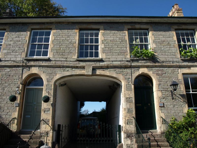
Entry Name: Ely House
Listing Date: 16 December 1976
Last Amended: 4 November 2005
Grade: II
Source: Cadw
Source ID: 6996
Building Class: Domestic
ID on this website: 300006996
Location: At end of built-up line on this side of street; below castle mound.
County: Powys
Town: Brecon
Community: Brecon (Aberhonddu)
Community: Brecon
Built-Up Area: Brecon
Traditional County: Brecknockshire
Tagged with: House
Built by the Brecon Railway Company in 1865.
Pair of mid C19 houses of unusual design, retaining their character, with Group Value with adjacent listed buildings in The Postern.
External links are from the relevant listing authority and, where applicable, Wikidata. Wikidata IDs may be related buildings as well as this specific building. If you want to add or update a link, you will need to do so by editing the Wikidata entry.


Other nearby listed buildings
