Approximate Location Map
Large Map »
Latitude: 52.2733 / 52°16'23"N
Longitude: -3.0062 / 3°0'22"W
OS Eastings: 331439
OS Northings: 264377
OS Grid: SO314643
Mapcode National: GBR B6.YSN4
Mapcode Global: VH772.V434
Plus Code: 9C4R7XFV+8G
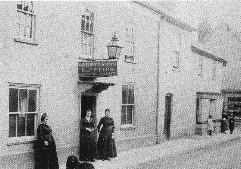
Entry Name: Farmer's Arms
Listing Date: 26 March 1985
Last Amended: 26 March 1985
Grade: II
Source: Cadw
Source ID: 8860
Building Class: Commercial
Also known as: Farmers Inn
Farmers Inn, Presteigne
ID on this website: 300008860
Location: Wide frontage below the eaves level of the Market Hall adjoining.
County: Powys
Community: Presteigne (Llanandras)
Community: Presteigne
Built-Up Area: Presteigne
Traditional County: Radnorshire
Tagged with: Pub
Probably C17, later alterations. 2 storeys, 4 windows, stucco front built out slightly below 1st floor level. Slate roof with wide eaves (coved to left only), end brick stack. Sash windows in flush frames, tripartite to ground floor right. 6-panel door under hood to left, second door to right.
Group value.
External links are from the relevant listing authority and, where applicable, Wikidata. Wikidata IDs may be related buildings as well as this specific building. If you want to add or update a link, you will need to do so by editing the Wikidata entry.


Other nearby listed buildings
