Latitude: 52.2405 / 52°14'25"N
Longitude: -3.1568 / 3°9'24"W
OS Eastings: 321108
OS Northings: 260888
OS Grid: SO211608
Mapcode National: GBR YZ.0ZJN
Mapcode Global: VH69K.7YH9
Plus Code: 9C4R6RRV+67
Entry Name: Wayside Cottage
Listing Date: 29 April 1993
Last Amended: 29 April 1993
Grade: II
Source: Cadw
Source ID: 9223
Building Class: Domestic
ID on this website: 300009223
Location: On the road, stepped down to left of No 9 (Wayside).
County: Powys
Community: New Radnor (Maesyfed)
Community: New Radnor
Traditional County: Radnorshire
Tagged with: Cottage
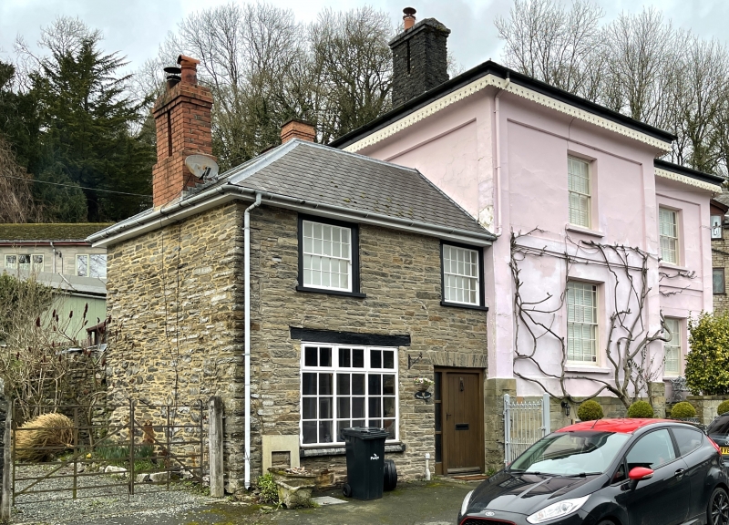
c1850, former service wing to adjoining house (Wayside).
Two storeys, coursed rubble, hipped slate roof, brick paired-flue stack. Six-panel door under flat voussoir head, large C20 multi-paned window to front left under timber lintel, first-floor windows twenty-pane sashes.
Included for group value with Wayside.
External links are from the relevant listing authority and, where applicable, Wikidata. Wikidata IDs may be related buildings as well as this specific building. If you want to add or update a link, you will need to do so by editing the Wikidata entry.


Other nearby listed buildings