Approximate Location Map
Large Map »
Latitude: 52.2411 / 52°14'27"N
Longitude: -3.1535 / 3°9'12"W
OS Eastings: 321330
OS Northings: 260951
OS Grid: SO213609
Mapcode National: GBR F0.0SH4
Mapcode Global: VH69K.9X6V
Plus Code: 9C4R6RRW+CH
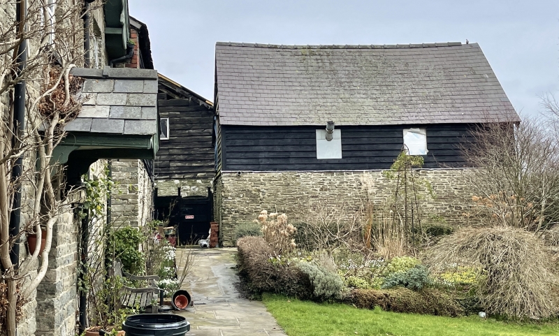
Entry Name: Stable Building running forward about 15m E.of Brookside Farmhouse
Listing Date: 29 April 1993
Last Amended: 29 April 1993
Grade: II
Source: Cadw
Source ID: 9232
Building Class: Domestic
ID on this website: 300009232
County: Powys
Community: New Radnor (Maesyfed)
Community: New Radnor
Traditional County: Radnorshire
Tagged with: Stable
C19, two storeys, rubble base walls, studwork loft, weatherboarded skin, slate roof. Boarded door, glazed small-pane window to right, shuttered loft opening.
Included for group value with the farmhouse and other listed outbuildings.
External links are from the relevant listing authority and, where applicable, Wikidata. Wikidata IDs may be related buildings as well as this specific building. If you want to add or update a link, you will need to do so by editing the Wikidata entry.


Other nearby listed buildings
