Latitude: 52.2414 / 52°14'29"N
Longitude: -3.1535 / 3°9'12"W
OS Eastings: 321331
OS Northings: 260987
OS Grid: SO213609
Mapcode National: GBR F0.0SH1
Mapcode Global: VH69K.9X6L
Plus Code: 9C4R6RRW+HH
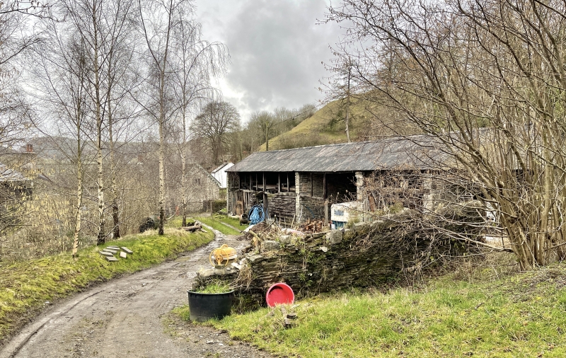
Entry Name: Cowsheds 30m to NE. of Brookside Farmhouse
Listing Date: 29 April 1993
Last Amended: 29 April 1993
Grade: II
Source: Cadw
Source ID: 9235
Building Class: Agriculture and Subsistence
ID on this website: 300009235
Location: Agricultural building backing on to Park Road and facing S to farmyard.
County: Powys
Community: New Radnor (Maesyfed)
Community: New Radnor
Traditional County: Radnorshire
Tagged with: Cowshed
Late C19 long eight-bay range of part open-fronted cowsheds with tollant. Rubble rear walls and gable walls, iron roof, weatherboarding to front of closed bays. Shallow pitch tie-beam trusses with small angle-braces.
Included for group value with the farmhouse and other outbuildings at Brookside Farm.
External links are from the relevant listing authority and, where applicable, Wikidata. Wikidata IDs may be related buildings as well as this specific building. If you want to add or update a link, you will need to do so by editing the Wikidata entry.


Other nearby listed buildings