Approximate Location Map
Large Map »
Latitude: 51.5071 / 51°30'25"N
Longitude: -3.5776 / 3°34'39"W
OS Eastings: 290610
OS Northings: 179863
OS Grid: SS906798
Mapcode National: GBR HD.J8TQ
Mapcode Global: VH5HJ.YD10
Plus Code: 9C3RGC4C+RX
Entry Name: National Westminster Bank
Listing Date: 29 September 1986
Last Amended: 29 September 1986
Grade: II
Source: Cadw
Source ID: 11260
Building Class: Commercial
ID on this website: 300011260
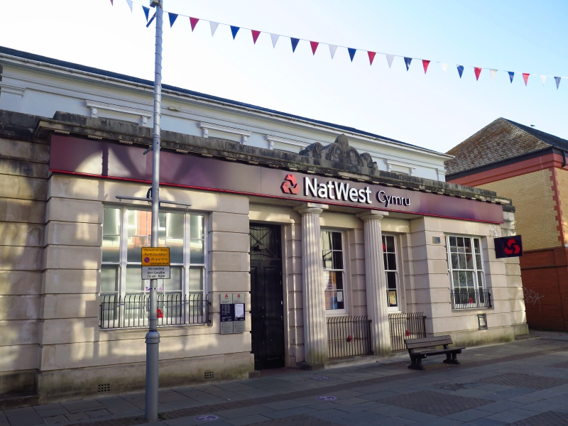
Mid C19 2-storey, 5-window late Georgian stucco front with end pilaster strips; partly concealed behind Edwardian single storey channelled ashlar classical front, set back at either end. Slate roof and wide eaves behind; parapeted flat roof in front with scrolled emblem over wide modillion cornice and frieze. Recessed central entrance with two Greek Doric columns; offset modern door. Small-pane sash windows, tripartite to ground floor outer bays, bracketed lintels to 1st floor. Sash window to right side.
External links are from the relevant listing authority and, where applicable, Wikidata. Wikidata IDs may be related buildings as well as this specific building. If you want to add or update a link, you will need to do so by editing the Wikidata entry.


Other nearby listed buildings
