Approximate Location Map
Large Map »
Latitude: 51.5025 / 51°30'8"N
Longitude: -3.5791 / 3°34'44"W
OS Eastings: 290491
OS Northings: 179354
OS Grid: SS904793
Mapcode National: GBR HD.JGG6
Mapcode Global: VH5HJ.XH7K
Plus Code: 9C3RGC2C+X9
Entry Name: Ashfield
Listing Date: 29 September 1986
Last Amended: 29 September 1986
Grade: II
Source: Cadw
Source ID: 11294
Building Class: Domestic
ID on this website: 300011294
Location: Set back from the road beside the by-pass.
County: Bridgend
Town: Bridgend
Community: Bridgend (Pen-y-bont ar Ogwr)
Community: Bridgend
Built-Up Area: Bridgend
Traditional County: Glamorgan
Tagged with: Architectural structure
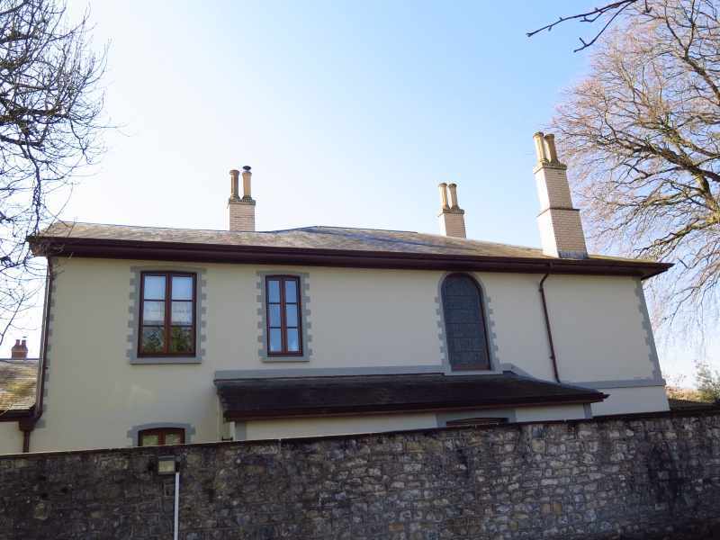
Regency hipped roof villa with painted brick and stucco elevations and gable ended eastern extension; black painted brick dressings; slate roofs, brick chimney stacks and wide boarded eaves.
2 window front facing Merthyr Mawr Road; cambered heads to casement windows with louvred shutters over veranda, which returns around the 4-window S front, on quatrefoil trellised cast ironwork uprights with Gothic spandrels. Main entrance to asymmetrical 3-window N side with stucco 1st floor; tall semi-circular headed window over later lean-to porch with cambered heads to 6-panel door end coloured glass sash; 2 casement windows to eastern arm. Stucco rear gable end with single storey part rubble storey part rubble surgery extension to E with single verge roof.
Drive entered between gate piers; garage at E end is not of special interest.
External links are from the relevant listing authority and, where applicable, Wikidata. Wikidata IDs may be related buildings as well as this specific building. If you want to add or update a link, you will need to do so by editing the Wikidata entry.


Other nearby listed buildings
