History in Structure

The Rectory

A Grade II Listed Building in Town (Y Dref), Merthyr Tydfil

More Photos »
Approximate Location Map
Large Map »

Coordinates

Latitude: 51.7462 / 51°44'46"N

Longitude: -3.3742 / 3°22'27"W

OS Eastings: 305222

OS Northings: 206168

OS Grid: SO052061

Mapcode National: GBR HN.15ZP

Mapcode Global: VH6CY.GCKQ

Plus Code: 9C3RPJWG+F8

Entry Name: The Rectory

Listing Date: 13 January 1988

Last Amended: 13 January 1988

Grade: II

Source: Cadw

Source ID: 11429

Building Class: Domestic

ID on this website: 300011429

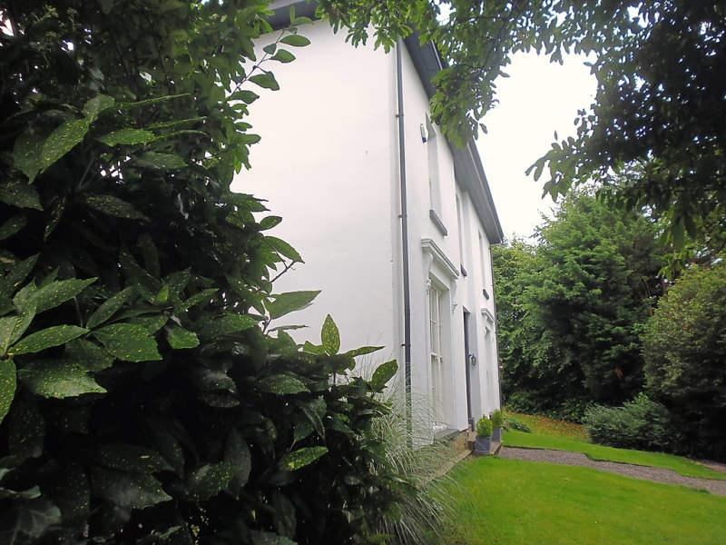
Location: Detached T-plan house set on hillside with road curving forward from right above.

County: Merthyr Tydfil

Community: Town (Y Dref)

Community: Town

Locality: Thomastown

Built-Up Area: Merthyr Tydfil

Traditional County: Glamorgan

Tagged with: Clergy house

Find accommodation in
Merthyr Tydfil

History

Shown on 1850 Tithe Map of Merthyr Tydfil.

Exterior

2-storey, 3-bay Regency stucco front with narrow recessed centre bay, hipped slate roof with wide boxed eaves. Sash windows in plain reveals, tripartites to ground-floor with cornices on voeute brackets. Modern centre doorway in glazed surround. Rear wing in similar style with original small-pane sashes.

External Links

External links are from the relevant listing authority and, where applicable, Wikidata. Wikidata IDs may be related buildings as well as this specific building. If you want to add or update a link, you will need to do so by editing the Wikidata entry.

Recommended Books

Other nearby listed buildings

  • II Sunny Bank
    High above road behind walled garden.
  • II Springfield Villa
    Uphill from Rectory and reached by a diagonal roadway from Bryntirion Road near Sandbrook House. Detached in walled garden.
  • II Bryn Heulog
    High above road behind walled garden.
  • II Merthyr Christian Centre
    On an elevated site against the hillside with gabled front closing the view up Church Street.
  • II Primrose Hill
    Detached house at top end of Church Street where the road turns at right-angles into Bryntirion Road.
  • II Former Unitarian Chapel
    Set in terraced row close to corner with Church Street.
  • II Newton House
    Pair of terraced houses stepped in slope towards Church Street.
  • II Newton House
    Pair of terraced houses stepped in slope towards Church Street.

BritishListedBuildings.co.uk is an independent online resource and is not associated with any government department. All government data published here is used under licence. Please do not contact BritishListedBuildings.co.uk for any queries related to any individual listed building, planning permission related to listed buildings or the listing process itself.

British Listed Buildings is a Good Stuff website.