Approximate Location Map
Large Map »
Latitude: 51.7445 / 51°44'40"N
Longitude: -3.374 / 3°22'26"W
OS Eastings: 305235
OS Northings: 205978
OS Grid: SO052059
Mapcode National: GBR HP.161P
Mapcode Global: VH6CY.GFN1
Plus Code: 9C3RPJVG+QC
Entry Name: Tydfil House
Listing Date: 13 January 1988
Last Amended: 13 January 1988
Grade: II
Source: Cadw
Source ID: 11472
Building Class: Domestic
ID on this website: 300011472
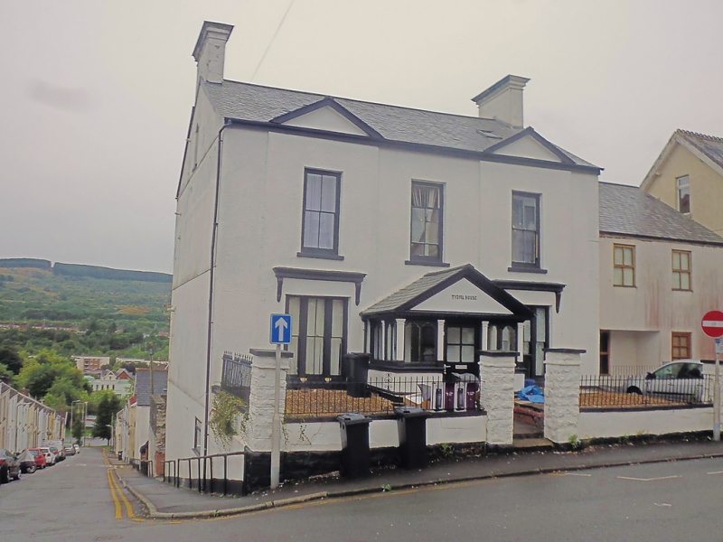
Location: Detached house at top of hill with Alma Street going down on left.
County: Merthyr Tydfil
Community: Town (Y Dref)
Community: Town
Built-Up Area: Merthyr Tydfil
Traditional County: Glamorgan
Tagged with: Building
2-storey, 3-window rendered Regency-style house with slightly advanced and pedimented outer bays. Slate roof (damaged), gable end stack with cornice. Sash windows with small-pane glazing, ground-floor tripartites with cornices on brackets over. Wide (later) gabled porch with pilastered and arched leaded lights.
Walled and railed forecourt. Taller 3-storey rear elevation modernised.
Interior partly burnt (March 1987).
External links are from the relevant listing authority and, where applicable, Wikidata. Wikidata IDs may be related buildings as well as this specific building. If you want to add or update a link, you will need to do so by editing the Wikidata entry.


Other nearby listed buildings
