Approximate Location Map
Large Map »
Latitude: 51.7139 / 51°42'49"N
Longitude: -3.7023 / 3°42'8"W
OS Eastings: 282490
OS Northings: 203052
OS Grid: SN824030
Mapcode National: GBR H7.37GG
Mapcode Global: VH5GH.S53Z
Plus Code: 9C3RP77X+G3
Entry Name: Farmer's Arms aqueduct over the Neath Canal
Listing Date: 28 March 1990
Last Amended: 15 December 2003
Grade: II
Source: Cadw
Source ID: 11852
Building Class: Water Supply and Drainage
ID on this website: 300011852
Location: On the Neath Canal at Farmer's Arms some 200m W of the roundabout on the A465 at Resolven.
County: Neath Port Talbot
Town: Neath
Community: Resolven (Resolfen)
Community: Resolven
Traditional County: Glamorgan
Tagged with: Aqueduct
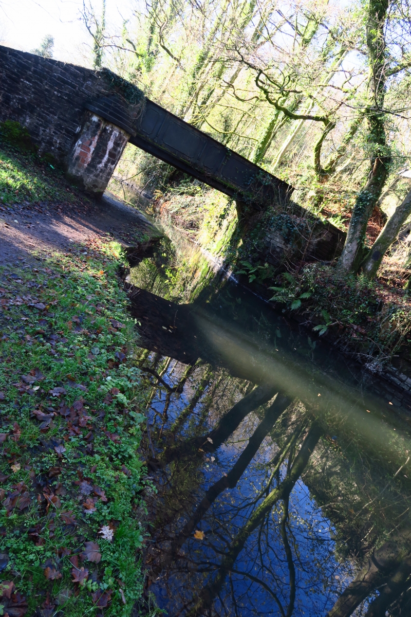
Cast iron aqueduct built c1835 at the Neath Abbey Ironworks to carry a stream over the Neath Canal. The aqueduct is similar to one at Glynneath dated 1835 carrying the Nant Ysgwrfa over the canal. The Neath Canal was originally planned from Pontneddfechan to Neath and was started in 1791 with Thomas Dadford Junior as General Surveyor. Thomas Sheasby replaced him in mid 1792 and the canal was completed in 1795. By 1799 it had been extended to the Giant's Grave near Briton Ferry.
Aqueduct, cast iron, flat bottom with panelled sides. Sides have alternating faces of half-round Tuscan columns and edged panelling with curved rebates in corners, the panelling itself alternating large and small. Pennant sandstone abutments with semi-circular piers of ashlar with stepped coping to rectangular tops with slab copings. To SE are squared sandstone block steps and parapets to river.
Included for its special historic interest as a cast iron aqueduct over an important C18 canal.
External links are from the relevant listing authority and, where applicable, Wikidata. Wikidata IDs may be related buildings as well as this specific building. If you want to add or update a link, you will need to do so by editing the Wikidata entry.


Other nearby listed buildings
