Latitude: 51.7311 / 51°43'51"N
Longitude: -5.1969 / 5°11'48"W
OS Eastings: 179336
OS Northings: 208436
OS Grid: SM793084
Mapcode National: GBR G2.H53Q
Mapcode Global: VH0V6.VRZ9
Plus Code: 9C3PPRJ3+C6
Entry Name: Memorial Clock Tower
Listing Date: 4 July 1979
Last Amended: 23 February 1998
Grade: II
Source: Cadw
Source ID: 13019
Building Class: Gardens, Parks and Urban Spaces
ID on this website: 300013019
Location: Situated in the centre of the village of Marloes, to the N of the main street and some 250m NW of the Church of Saint Peter.
County: Pembrokeshire
Town: Haverfordwest
Community: Marloes and St. Brides (Marloes a Sain Ffrêd)
Community: Marloes and St. Brides
Locality: Marloes
Traditional County: Pembrokeshire
Tagged with: Clock tower
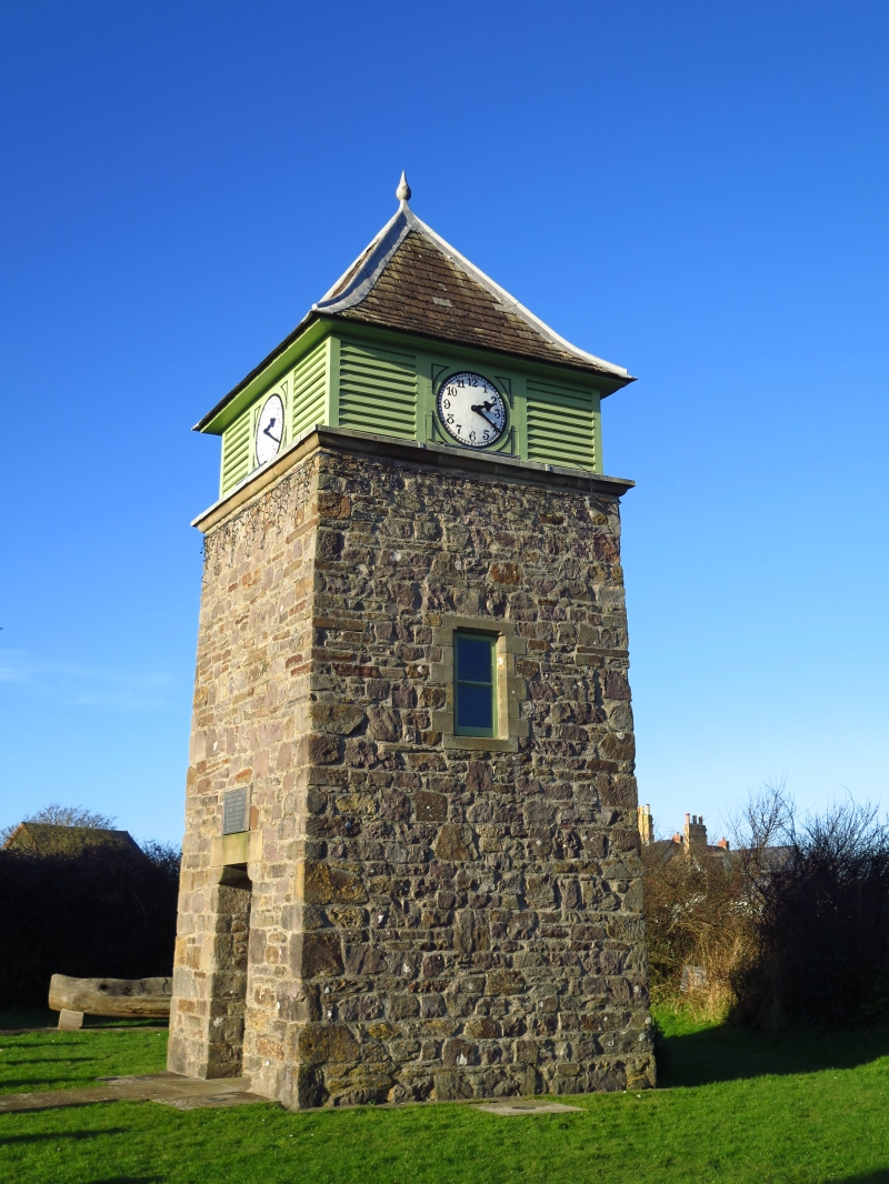
Memorial clock-tower built in 1904 to the memory of the 4th Baron Kensington by the Pembrokeshire Liberal Association. Said to have been erected under the supervision of Lord Kensington's agent John Fergusson. An attractive design influenced by the Arts and Crafts movement. The clock was made by J.W. Benson of London.
Clock tower, rubble stone battered square tower some 20' (6 metres) high with S doorway and small side windows at mid height. Doorway has slab lintel carried on rounded corbels. Timber low clock-stage with clock-face each side flanked by louvred square panels under overhanging bellcast pyramid slate roof with lead finial. Plaque over door records that the tower was built in memory of William 4th Baron Kensington, died October 1896, by members of the Pembrokeshire Liberal Association.
An unusual Arts-and-Crafts-influenced design, the focal point of Marloes village.
External links are from the relevant listing authority and, where applicable, Wikidata. Wikidata IDs may be related buildings as well as this specific building. If you want to add or update a link, you will need to do so by editing the Wikidata entry.


Other nearby listed buildings