Approximate Location Map
Large Map »
Latitude: 51.7828 / 51°46'58"N
Longitude: -3.0155 / 3°0'55"W
OS Eastings: 330044
OS Northings: 209840
OS Grid: SO300098
Mapcode National: GBR F5.YYFG
Mapcode Global: VH79D.PG64
Plus Code: 9C3RQXMM+4R
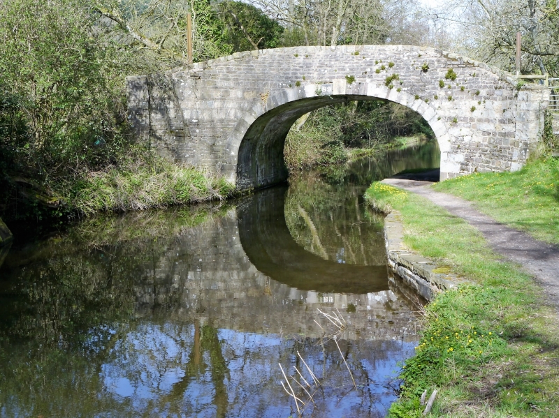
Entry Name: Barn Bridge ( Canal Bridge no 89 )
Listing Date: 15 March 1996
Last Amended: 15 March 1996
Grade: II
Source: Cadw
Source ID: 17645
Building Class: Transport
ID on this website: 300017645
History: The Brecknock and Abergavenny Canal was promoted in 1792 to connect the upper Usk valley to the Monmouthshire Canal at Pontymoile and from there to the sea at Newport. Construction began in 1797, with Thomas Dadford as engineer, and the first section, from Gilwern to Llangynidr was completed in that year with the stretch as far as Brecon following in 1800. Work then stopped for a time with the result that the section to the Blaenavon Road east of Govilon was not completed until 1805, now with Thomas Cartwright as engineer. Further funds had to be raised and the last section from west of Llanfoist to Pontymoile was completed between 1809 and 1812, with William Crosley as engineer. Linked to tramroads, the canal was an important artery for trade in iron, lime and coal. In 1865 the Monmouthshire and the Brecknock and Abergavenny Canal Companies merged becoming the Monmouthshire and Brecon Canal Company. Later still the canal was bought out by the Great Western Railway and gradually the canal was run down until it was finally abandoned in 1962. Restoration work was begun in 1964.
Description: This bridge (No 89) lies within the section constructed by William Crosley between 1809 and 1812. Rubble canal bridge, unusually uncoursed, spanning canal and tow-path to east. Segmental arch has keystone and the parapet is curved around at the downhill end.
Included for its special interest as one of the surviving early C19 Brecknock and Abergavenny canal bridges.
References: Nicholson's guides to the Waterways, vol 3, South-west
p49-55, (n.d.).
R A Stevens, Brecknock & Abergavenny and Monmouthshire Canals (Towpath Guide No 2), (Cambridge, 1974), p49-55.
External links are from the relevant listing authority and, where applicable, Wikidata. Wikidata IDs may be related buildings as well as this specific building. If you want to add or update a link, you will need to do so by editing the Wikidata entry.


Other nearby listed buildings
