Approximate Location Map
Large Map »
Latitude: 51.7201 / 51°43'12"N
Longitude: -4.8062 / 4°48'22"W
OS Eastings: 206260
OS Northings: 206100
OS Grid: SN062061
Mapcode National: GBR GC.6L7K
Mapcode Global: VH2PJ.N106
Plus Code: 9C3QP5CV+2G
Entry Name: Milepost on A4075
Listing Date: 8 April 1997
Last Amended: 8 April 1997
Grade: II
Source: Cadw
Source ID: 18298
Building Class: Transport
ID on this website: 300018298
Location: On the east side of the A4075, southwest of the school at Cresselly
County: Pembrokeshire
Community: Jeffreyston
Community: Jeffreyston
Locality: Cresselly
Traditional County: Pembrokeshire
Tagged with: Milestone
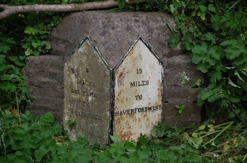
Milepost erected under the Tavernspite Turnpike Trust, before 1844.
Pair of flat castings recording the distances to Haverfordwest and Pembroke, and marked Marychurch foundry, mounted on an angled stone or concrete block.
A well-preserved example of a distinctive local type of mile-post
External links are from the relevant listing authority and, where applicable, Wikidata. Wikidata IDs may be related buildings as well as this specific building. If you want to add or update a link, you will need to do so by editing the Wikidata entry.


Other nearby listed buildings
