Approximate Location Map
Large Map »
Latitude: 51.7936 / 51°47'37"N
Longitude: -4.7144 / 4°42'51"W
OS Eastings: 212908
OS Northings: 214039
OS Grid: SN129140
Mapcode National: GBR CX.Y39V
Mapcode Global: VH2P6.75KT
Plus Code: 9C3QQ7VP+F7
Entry Name: Crinow and Lampeter Velfrey Parish Boundary Stone
Listing Date: 15 October 1997
Last Amended: 15 October 1997
Grade: II
Source: Cadw
Source ID: 18998
Building Class: Civil
ID on this website: 300018998
Location: At N side of the unclassified road on the parish boundary near Clyn Pattel.
County: Pembrokeshire
Community: Lampeter Velfrey (Llanbedr Felfre)
Community: Lampeter Velfrey
Locality: Crinow
Traditional County: Pembrokeshire
Tagged with: Architectural structure
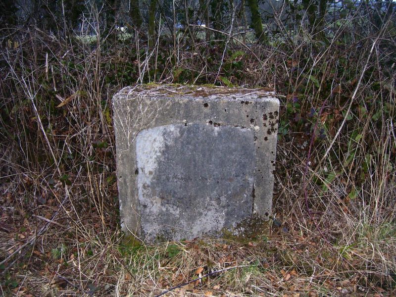
A stone probably of early C19 date. Its purpose was very probably to define the boundary in order to avert disputes over which parish was liable for relieving paupers under the old Poor Law. The existence of a similar stone at Tavernspite and possibly a lost third one on the Narberth to Prince's Cross road suggests these stones were put up at the initiative of the Lampeter Velfrey parish guardians. With the formation of the Narberth Poor Law Union under the 1834 Act the stones would have become redundant.
The stone has recently been moved back from its original position for road widening and traffic safety. It is now set in a concrete surround.
A stone 1 m high and 0.8 m wide with a segmentally rounded top. Carved indicating hands point left and right. The lettering below the left-pointing hand reads 'Crinow Parish' and below the right-pointing hand 'Lampeter Parish'.
At the top centre an Ordnance Survey bench-mark arrow has been carved, probably c.1860.
Listed as a relic of the Old Poor Law, with neatly cut lettering and carving.
External links are from the relevant listing authority and, where applicable, Wikidata. Wikidata IDs may be related buildings as well as this specific building. If you want to add or update a link, you will need to do so by editing the Wikidata entry.


Other nearby listed buildings
