Approximate Location Map
Large Map »
Latitude: 53.0446 / 53°2'40"N
Longitude: -3.0761 / 3°4'33"W
OS Eastings: 327954
OS Northings: 350242
OS Grid: SJ279502
Mapcode National: GBR 72.D98X
Mapcode Global: WH77S.QQDT
Plus Code: 9C5R2WVF+RH
Entry Name: Church of St Andrew
Listing Date: 22 April 1998
Last Amended: 22 April 1998
Grade: II
Source: Cadw
Source ID: 19725
Building Class: Religious, Ritual and Funerary
Also known as: St Andrew's Church, Minera
ID on this website: 300019725
Location: Situated some 100m S from Wern Farm on the B5426 from Minera S to Aber-oer.
County: Wrexham
Town: Wrexham
Community: Minera (Mwynglawdd)
Community: Minera
Locality: The Wern
Traditional County: Denbighshire
Tagged with: Tin tabernacle
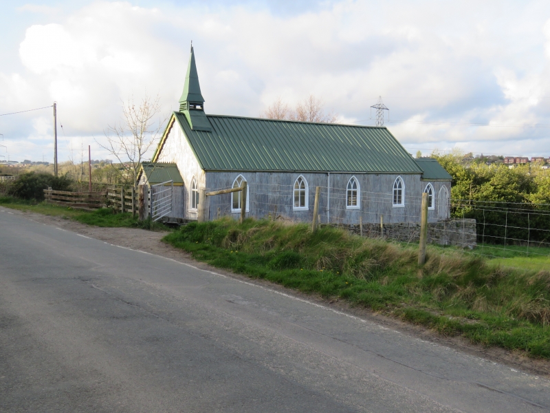
Late C19 mission church built for the district of Esclusham Above (New Brighton) in 1892, presumably to a standardised prefabricated design with corrugated-iron cladding to timber-frame.
Church, corrugated iron cladding to timber frame. Roof cladding renewed in box-profile metal sheet. Four-window church with pointed Y-tracery timber windows, W spirelet and W porch. W spirelet has base splayed over the ridge, squat louvred stage for single bell and sheet-metal clad 4-sided spire splayed out at base. Porch is gabled with original crested ridge and has ledged door. W wall of church has pointed window each side of porch. E end has pointed window set high. At SE corner is attached a small vestry in matching materials with one pointed window and one pointed ledged door on S.
Included as a particularly unaltered example of the corrugated-iron mission churches built in relatively large numbers in the period 1890-1914 but now becoming rare.
External links are from the relevant listing authority and, where applicable, Wikidata. Wikidata IDs may be related buildings as well as this specific building. If you want to add or update a link, you will need to do so by editing the Wikidata entry.


Other nearby listed buildings
