Approximate Location Map
Large Map »
Latitude: 52.963 / 52°57'46"N
Longitude: -3.0806 / 3°4'50"W
OS Eastings: 327512
OS Northings: 341168
OS Grid: SJ275411
Mapcode National: GBR 72.K86H
Mapcode Global: WH785.NS7D
Plus Code: 9C4RXW79+5P
Entry Name: Lime Kilns
Listing Date: 11 June 1998
Last Amended: 11 June 1998
Grade: II
Source: Cadw
Source ID: 19962
Building Class: Industrial
ID on this website: 300019962
Location: Situated on south side of Llangollen Canal 200 m NE of village.
County: Wrexham
Town: Llangollen
Community: Llangollen Rural (Llangollen Wledig)
Community: Llangollen Rural
Locality: Froncysyllte
Built-Up Area: Froncysyllte
Traditional County: Denbighshire
Tagged with: Lime kiln
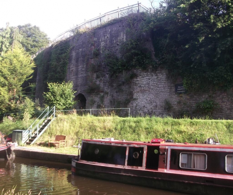
Lime kilns, possibly built in association with the canal (originally known as the Ellesmere Canal), 1795-1805. Different access arches suggest that the lime kilns were not all built at the same time. Shown on 1843 Tithe Map and apparently known as Biddulph's Limekilns in 1822 when a new road (the A5) was constructed between there and Chirk. A smaller block of lime kilns E of main site has been much altered and is incorporated in gardens of dwellings.
A battery of six large lime kilns built into the steep escarpment between the canal and the A5 above. High retaining wall in roughly squared and coursed limestone, the centre section of which has been repaired in concrete. Easternmost access arch is pointed with three brick voussoir rings. The next two access arches are segmental. The three western acess arches (all blocked) are round-headed each with a single ring of stone voussoirs. Much of the retaining wall over two westernmost kilns has fallen.
Listed as an impressive set of large-scale canal-side lime-kilns, survival of early industrial history of the region.
External links are from the relevant listing authority and, where applicable, Wikidata. Wikidata IDs may be related buildings as well as this specific building. If you want to add or update a link, you will need to do so by editing the Wikidata entry.


Other nearby listed buildings
