Approximate Location Map
Large Map »
Latitude: 51.8848 / 51°53'5"N
Longitude: -3.1872 / 3°11'13"W
OS Eastings: 318387
OS Northings: 221364
OS Grid: SO183213
Mapcode National: GBR YY.RJ1C
Mapcode Global: VH6C8.PWYG
Plus Code: 9C3RVRM7+W4
Entry Name: Zoar Chapel
Listing Date: 21 October 1998
Last Amended: 21 October 1998
Grade: II
Source: Cadw
Source ID: 20678
Building Class: Religious, Ritual and Funerary
Also known as: Zoar Independent Chapel
ID on this website: 300020678
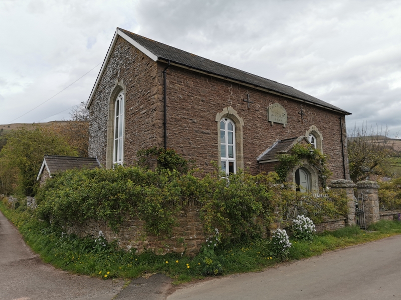
Location: Situated on the western side of Tretower at the junction between the lane into the village and that up to the A479. Set back behind railed forecourt with gates and gate-piers.
County: Powys
Community: Llanfihangel Cwmdu with Bwlch and Cathedine (Llanfihangel Cwm Du gyda Bwlch a Chathedin)
Community: Llanfihangel Cwmdu with Bwlch and Cathedine
Locality: Tretower
Traditional County: Brecknockshire
Tagged with: Chapel
Dated 1844; some later alterations.
Simple Gothic broad front derived from the traditional long-wall type of chapel. Local rubble masonry with slate roof; cement-rendered right hand gable end. 2 tall windows with freestone surrounds flank a central porch. The 2-light, Y-patterned, windows have pointed arched heads and are divided by thick vertical glazing bars and thinner horizontal glazing bars; renewed glazing. The gabled porch has kneelers, side lights and double panelled doors within a pointed-arched entrance. Above the porch is the sandstone date plaque inscribed 'Erected Zoar 1844'; flanked by brace plates. Tall 3-light gable end windows with intersecting tracery heads. Blank rear elevation with chimney.
Listed for its special interest as a surviving mid C19 non-conformist rural chapel.
External links are from the relevant listing authority and, where applicable, Wikidata. Wikidata IDs may be related buildings as well as this specific building. If you want to add or update a link, you will need to do so by editing the Wikidata entry.


Other nearby listed buildings
