Approximate Location Map
Large Map »
Latitude: 51.8489 / 51°50'55"N
Longitude: -3.1542 / 3°9'15"W
OS Eastings: 320594
OS Northings: 217327
OS Grid: SO205173
Mapcode National: GBR F0.TL8C
Mapcode Global: VH6CH.8SWJ
Plus Code: 9C3RRRXW+G8
Entry Name: Canal House
Listing Date: 21 October 1998
Last Amended: 21 October 1998
Grade: II
Source: Cadw
Source ID: 20707
Building Class: Domestic
ID on this website: 300020707
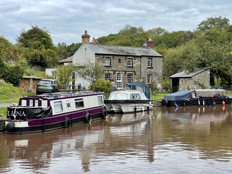
Location: Located N of Upper Yard Bridge (Canal Bridge No 115) and the Brecknock Boat Company’s limekilns, on the W side of the Monmouthshire and Brecon Canal, near Llangattock Wharf. The front faces E.
County: Powys
Community: Llangattock (Llangatwg)
Community: Llangattock
Locality: Llangattock Wharf
Built-Up Area: Llangattock
Traditional County: Brecknockshire
Tagged with: House
The Brecon and Abergavenny Canal was proposed in 1792 to connect the Upper Usk valley to the Monmouthshire Canal at Pontymoile and from there to the sea at Newport. The middle section of the canal, between Gilwern and Talybont and including Llangattock, was cut between 1797 and 1799.
Said to be the Wharfinger’s house, built by the Brecknock and Abergavenny Canal Co. in 1840. This is supported by a tablet on the front of the house which reads B & AC / 1840. The house is shown on the Llangattock Tithe Map of 1845 in the same plot as the limekilns. On the front door-frame is an inscription reading MR & C Co. 144. This is a reference to the Monmouthshire Railway and Canal Company which bought the canal in 1865. A reconstruction drawing shows a cart shed and tramroad at the N end of the house. This was replaced later by an extension, built after the tramroad and limekilns had gone out of use in the later C19.
Symmetrical 2-window, 2-storey main range with central doorway, constructed of roughly coursed sandstone. Two-storey, 1-window extension to the N, slightly set back, of snecked masonry with stone dressings. All under a slate roof with brick end stacks, yellow brick to the main range and red brick to the extension. The openings are under segmental heads with voussoirs, and all the windows are 12-pane horned sashes. The front door is glazed with small panes. A continuous hoodmould rises over the front door and its flanking windows, with hoodmoulds in the same style over the upper storey windows of the main range. Between them and just below the eaves is a tablet bearing an inscription.
The S gable end is rendered. There is an added flat-roofed single storey extension against the S end and continuing round the rear. It contains a C20 half-lit door to the front. (There is a small upper storey extension to the rear.) The N gable end is of masonry to the ground floor, rebuilt in red brick at the upper level and containing a C20 window.
No access to interior at time of inspection (August 1997)
Listed for its special interest as an important survival of a Brecknock and Abergavenny Canal building reflecting industrial activity at Llangattock Wharf.
Group value with other listed items associated with Llangattock Wharf.
External links are from the relevant listing authority and, where applicable, Wikidata. Wikidata IDs may be related buildings as well as this specific building. If you want to add or update a link, you will need to do so by editing the Wikidata entry.


Other nearby listed buildings
