Latitude: 51.5799 / 51°34'47"N
Longitude: -3.1255 / 3°7'31"W
OS Eastings: 322109
OS Northings: 187377
OS Grid: ST221873
Mapcode National: GBR J0.CNK2
Mapcode Global: VH6DV.SK17
Plus Code: 9C3RHVHF+WR
Entry Name: 3
Listing Date: 5 March 1999
Last Amended: 5 March 1999
Grade: II
Source: Cadw
Source ID: 21449
Building Class: Domestic
ID on this website: 300021449
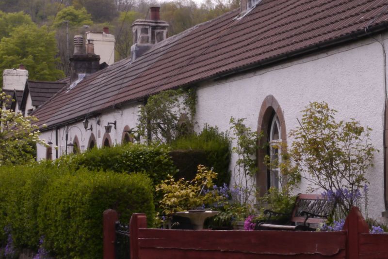
Location: On the N side of the main road through Draethen. No 3 is centre-L in a row of 4.
County: Caerphilly
Community: Rudry (Rhydri)
Community: Rudry
Locality: Draethen
Traditional County: Glamorgan
Tagged with: Building
Pebble-dashed front wall. The front door is boarded with cast iron strap hinges, the 2-light casement windows are part renewed in original openings.
Not inspected at time of survey but originally a 2-room plan.
Included as a rare surviving example of a row of early C19 estate cottages in this region.
External links are from the relevant listing authority and, where applicable, Wikidata. Wikidata IDs may be related buildings as well as this specific building. If you want to add or update a link, you will need to do so by editing the Wikidata entry.


Other nearby listed buildings