Approximate Location Map
Large Map »
Latitude: 51.4618 / 51°27'42"N
Longitude: -3.4479 / 3°26'52"W
OS Eastings: 299505
OS Northings: 174638
OS Grid: SS995746
Mapcode National: GBR HK.M5FZ
Mapcode Global: VH6F8.6J28
Plus Code: 9C3RFH62+PR
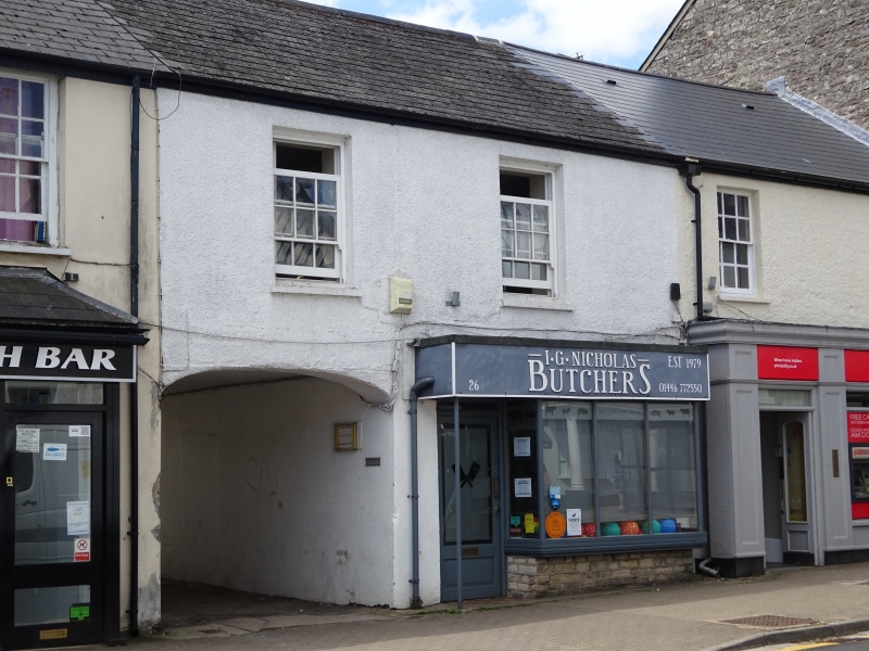
Entry Name: 26
Listing Date: 16 September 1999
Last Amended: 21 June 2001
Grade: II
Source: Cadw
Source ID: 22300
Building Class: Commercial
ID on this website: 300022300
Location: Attached to No.22.
County: Vale of Glamorgan
Community: Cowbridge with Llanblethian (Y Bont-faen a Llanfleiddan)
Community: Cowbridge with Llanblethian
Locality: Cowbridge
Built-Up Area: Cowbridge
Traditional County: Glamorgan
Tagged with: Building
Probably early C19.
Wider two bay frontage than to No 22. Roughcast cladding. On ground floor, wide segmental vehicular archway to left hand and wide modern shop front to right hand. On first floor, two top-hung casements, replacing sash windows.
Included for group value.
External links are from the relevant listing authority and, where applicable, Wikidata. Wikidata IDs may be related buildings as well as this specific building. If you want to add or update a link, you will need to do so by editing the Wikidata entry.


Other nearby listed buildings
