Approximate Location Map
Large Map »
Latitude: 51.7735 / 51°46'24"N
Longitude: -3.174 / 3°10'26"W
OS Eastings: 319093
OS Northings: 208962
OS Grid: SO190089
Mapcode National: GBR YZ.ZFB9
Mapcode Global: VH6CV.XPWB
Plus Code: 9C3RQRFG+9C
Entry Name: Chapel Farm
Listing Date: 30 September 1999
Last Amended: 30 September 1999
Grade: II
Source: Cadw
Source ID: 22384
Building Class: Domestic
ID on this website: 300022384
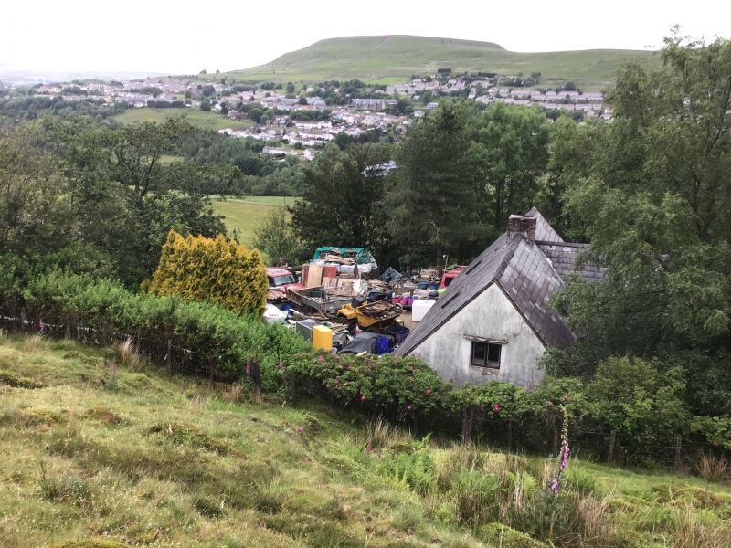
Location: Isolated location on the steep W side of the valley, facing over Blaina. Reached at end of track leading from A467, past Ysgubor-fach.
County: Blaenau Gwent
Community: Nantyglo and Blaina (Nantyglo a Blaenau)
Community: Nantyglo and Blaina
Locality: Coalbrookvale
Traditional County: Monmouthshire
Tagged with: Architectural structure
Largely mid C16 and C17, with earlier origins said to date from 1474. The small farmhouse probably originally consisted of an open hall of cruck construction, possibly late medieval or early C16. A massive fireplace was added at the downhill end in the mid C16, probably at the same time that the walls were rebuilt in stone. In the early C17, the house was reordered and the floor was inserted, the plan consisting of hall with chimney entry and unheated inner parlour: the cow-house, located on the lower side was probably added later. Of the C17 is a (now detached) window sill, which has rebates for stout diamond mullions. Originally known as Ty Gronw, the present name dating from the period after the farm was bequeathed to the parish church. In private ownership from the 1930s. Much restoration in later C20, when derelict, including the rebuilding of the cowhouse for domestic use, and the addition of the south wing.
Single storey, built into hillside. Rubble walls, massive and battered to original upper part. Slate roof. Small rubble chimney stack towards centre of ridge. All windows have been replaced. Entrance front faces N. Original house forms the two right bays, which has two windows set towards the right end, the right window being smaller. Rebuilt cowhouse end forms two left bays, slightly set back: door to right, window to left. Two rooflights to front roofslope. Rear wing with slightly lower ridgeline: C20 conservatory set in SE angle with main house. Two left bays of rear elevation (original house) with two windows: rooflight above.
Plan consists of hall with inner parlour and downslope cow-house, rebuilt in late C20 as a kitchen. Hall has two pairs of full crucks and C17 ceiling consisting of massive beams having joists with ogee stop-chamfers. Ceiling joists have been slightly raised. Large C16 stone fireplace with monolithic chamfered jambs and unusually massive chamfered monolithic lintel, partially obscured by the ceiling, which postdates the fireplace. Winding chimney stair to left of fireplace with later timber treads. To right of fireplace is original entry (blocked) with plain heavy timber frame. Between hall and parlour is and post and panel partition, the posts with stop-chamfers. Small unheated parlour has C17 ceiling joists; stop-chamfers with long tongues. Crucks visible from upper floor: massive collars, paired purlins.
Listed as the most complete survivor of the few cruck-framed houses in the Eastern Valleys. Despite many alterations, the house has retained several important features of the C16 and C17.
External links are from the relevant listing authority and, where applicable, Wikidata. Wikidata IDs may be related buildings as well as this specific building. If you want to add or update a link, you will need to do so by editing the Wikidata entry.


Other nearby listed buildings
