Approximate Location Map
Large Map »
Latitude: 51.5878 / 51°35'16"N
Longitude: -2.9975 / 2°59'50"W
OS Eastings: 330991
OS Northings: 188132
OS Grid: ST309881
Mapcode National: GBR J5.C4QZ
Mapcode Global: VH7BD.0C64
Plus Code: 9C3VH2Q3+42
Entry Name: Lamb PH
Listing Date: 31 March 2000
Last Amended: 31 March 2000
Grade: II
Source: Cadw
Source ID: 23104
Building Class: Commercial
Also known as: The Lamb, Newport
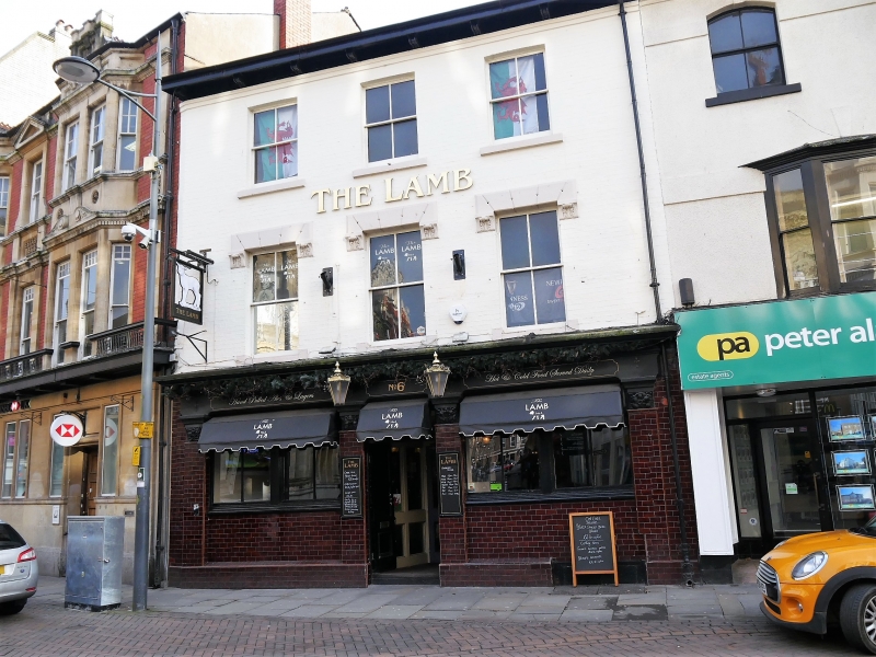
The Lamb
ID on this website: 300023104
Location: Opposite Cambrian Road.
County: Newport
Community: Stow Hill
Community: Stow Hill
Built-Up Area: Newport
Traditional County: Monmouthshire
Tagged with: Pub
Later C19 public house.
Three storey, 3 window painted front. Bracketed eaves. Four-pane hornless sash windows to first and second floors. On ground floor glazed tiles public house front; entablature over central entrance flanked by paired casement windows; piers with floral capitals.
Included for group value with adjacent listed building.
External links are from the relevant listing authority and, where applicable, Wikidata. Wikidata IDs may be related buildings as well as this specific building. If you want to add or update a link, you will need to do so by editing the Wikidata entry.


Other nearby listed buildings
