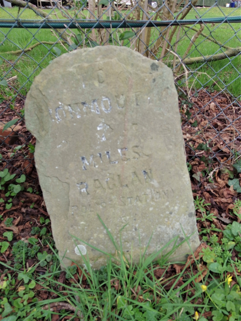
Milestone on the old Monmouth road
A Grade II Listed Building in Raglan, Monmouthshire
Coordinates
Latitude: 51.7699 / 51°46'11"N
Longitude: -2.838 / 2°50'16"W
OS Eastings: 342272
OS Northings: 208251
OS Grid: SO422082
Mapcode National: GBR FF.ZLNB
Mapcode Global: VH79H.RSJ1
Plus Code: 9C3VQ596+XR
Entry Name: Milestone on the old Monmouth road
Listing Date: 31 January 2001
Grade: II
Source: Cadw
Source ID: 24735
Building Class: Communications
ID on this website: 300024735
Location: Situated about 1km E of Raglan on the N verge of the old A40 just E of junction with new road and 10m beyond by-road to Tregare.
County: Monmouthshire
Town: Raglan
Community: Raglan (Rhaglan)
Community: Mitchel Troy
Locality: Raglan
Traditional County: Monmouthshire
Tagged with:
Milestone
History
Mid to later C19 stone milestone.
Exterior
Stone milestone, once whitewashed, with black painted capital letters reading "To Monmouth 7 Miles, Raglan Police Station 3/4".
Reasons for Listing
Included for transport history interest, marking the line of the former main road to Monmouth.
External Links
External links are from the relevant listing authority and, where applicable, Wikidata.
Wikidata IDs may be related buildings as well as this specific building. If you want to add or update a link, you
will need to do so by editing the Wikidata entry.
Recommended Books
Other nearby listed buildings
-
II
Castle Farmhouse
Prominently sited adjacent to Raglan Castle the farm is approached from its own drive and shielded from close public view.
-
I
Raglan Castle
Magnificently sited 0.25km N of Raglan and reached by private drive from the A 40.
-
II
The Warrage
Situated approximately 2km NE of Raglan on the E side of the by-road to Tregare. The Farmhouse faces S with farmyard ranges to N.
-
II
Farmyard Range at the Warrage
The Warrage is situated approximately 2km NE of Raglan on the eastern side of the by-road to Tregare. This long farmyard range faces E and is set in the slope parallel to the road; attached to the NW
-
II
The Old Post Office
Castle Street runs N from Beaufort Square in Raglan towards the castle. No 9 on the E side is part of a single range with No 8.
-
II
8 Castle Street, 8, Castle Street, Raglan, Raglan, NP5 2DS
Castle Street runs N from the main crossroads at Beaufort Square in Raglan towards the castle.
-
II
7 Castle Street, 7, Castle Street, Raglan, Raglan, NP5 2DS
Situated at right end of group of roughcast houses on the E side of Castle Street, just after a large late C19 red brick house.
-
II
The Malt House
Castle Street runs N from the main crossroads at Beaufort Square in Raglan towards the castle.