Approximate Location Map
Large Map »
Latitude: 51.5998 / 51°35'59"N
Longitude: -3.0078 / 3°0'28"W
OS Eastings: 330291
OS Northings: 189481
OS Grid: ST302894
Mapcode National: GBR J5.BG3H
Mapcode Global: VH7BC.T17W
Plus Code: 9C3RHXXR+WV
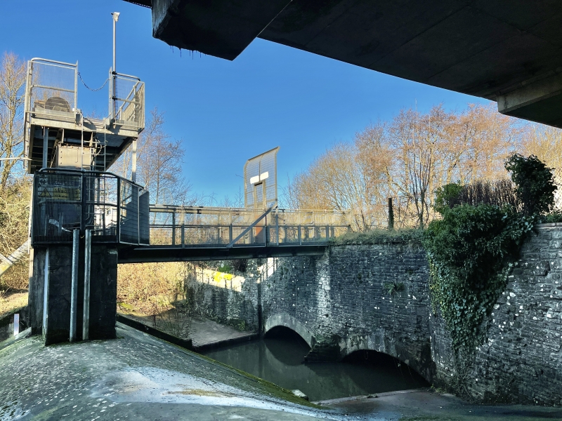
Entry Name: Aqueduct over Malpas Brook, Monmouthshire and Brecon Canal (partly in Bettws Community)
Listing Date: 24 June 1999
Last Amended: 28 August 2001
Grade: II
Source: Cadw
Source ID: 25736
Building Class: Transport
ID on this website: 300025736
Location: Now situated almost under the M4 motorway by the Newport (Malpas Road) junction 26.
County: Newport
Town: Newport
Community: Shaftesbury
Community: Shaftesbury
Locality: Crindau
Built-Up Area: Newport
Traditional County: Monmouthshire
See record number 21953 in Bettws Community for full description of this bridge.
External links are from the relevant listing authority and, where applicable, Wikidata. Wikidata IDs may be related buildings as well as this specific building. If you want to add or update a link, you will need to do so by editing the Wikidata entry.


Other nearby listed buildings
