Approximate Location Map
Large Map »
Latitude: 51.6021 / 51°36'7"N
Longitude: -3.0116 / 3°0'41"W
OS Eastings: 330034
OS Northings: 189732
OS Grid: ST300897
Mapcode National: GBR J5.B760
Mapcode Global: VH7B5.RZ7R
Plus Code: 9C3RJX2Q+R9
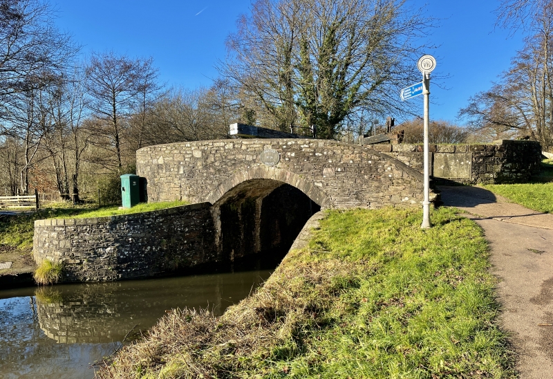
Entry Name: Gwastad Bridge over the Monmouthshire and Brecon Canal and Lock (partly in Bettws community)
Listing Date: 24 June 1999
Last Amended: 28 August 2001
Grade: II
Source: Cadw
Source ID: 25734
Building Class: Transport
ID on this website: 300025734
Location: Situated W of Blaen-y-pant Crescent, with open fields to the W.
County: Newport
Town: Newport
Community: Shaftesbury
Community: Shaftesbury
Locality: Crindau
Built-Up Area: Newport
Traditional County: Monmouthshire
See record number 21952 in Bettws Community for full description of this bridge.
External links are from the relevant listing authority and, where applicable, Wikidata. Wikidata IDs may be related buildings as well as this specific building. If you want to add or update a link, you will need to do so by editing the Wikidata entry.


Other nearby listed buildings
