Approximate Location Map
Large Map »
Latitude: 52.1489 / 52°8'56"N
Longitude: -4.0583 / 4°3'29"W
OS Eastings: 259265
OS Northings: 252071
OS Grid: SN592520
Mapcode National: GBR DS.6Q10
Mapcode Global: VH4GQ.L7WY
Plus Code: 9C4Q4WXR+HM
Entry Name: Bridge at Derry Ormond
Listing Date: 10 March 2003
Last Amended: 10 March 2003
Grade: II
Source: Cadw
Source ID: 80945
Building Class: Gardens, Parks and Urban Spaces
ID on this website: 300080945
Location: Within the park of the former Derry Ormond mansion, about 200m W of Betws Bledrws.
County: Ceredigion
Community: Llangybi
Community: Llangybi
Locality: Betws Bledrws
Traditional County: Cardiganshire
Tagged with: Bridge
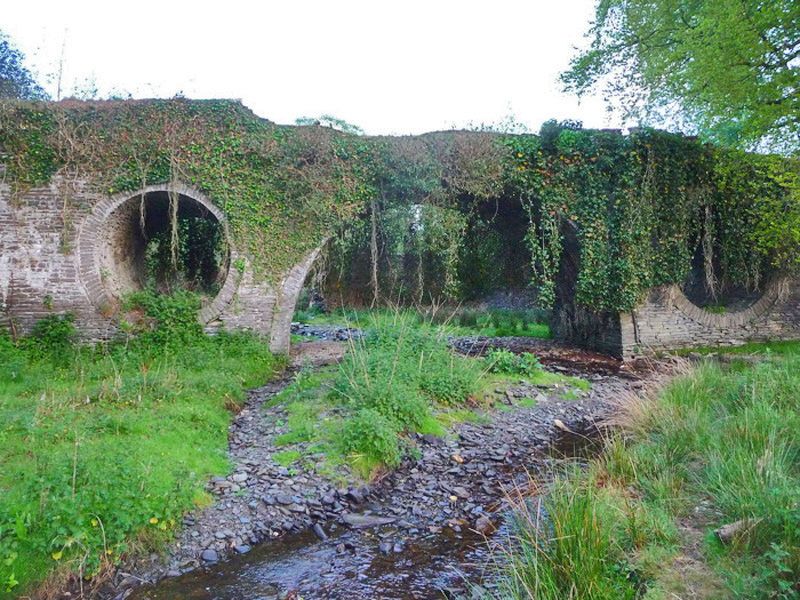
The house at Derry Ormond, described in 1833 as an "elegant modern mansion" was designed by the distinguished architect C R Cockerell in the 1820s, but demolished in 1953. The bridge, also by Cockerell, is associated with the landscape park of the house. When the lake above was in water, the circular overflow holes flanking the main arch appeared as arches.
The park is entered in the Cadw/Icomos Register of Landscapes, Parks and gardens of special interest in Wales Ref No PGW (Dy) 48 (Cer).
Stone bridge with large central arch flanked by large circular overflow holes, in turn flanked by smaller semi-circular holes at ends of bridge. Parapets of bridge partly ruinous, but have quartz lumps set into tops where they survive to full height. Pair of iron gates between slender iron posts at N end of bridge.
Fine garden bridge by this important architect, a significant part of the early C19 landscaped park.
External links are from the relevant listing authority and, where applicable, Wikidata. Wikidata IDs may be related buildings as well as this specific building. If you want to add or update a link, you will need to do so by editing the Wikidata entry.


Other nearby listed buildings
