Latitude: 51.6267 / 51°37'36"N
Longitude: -3.3305 / 3°19'49"W
OS Eastings: 307996
OS Northings: 192825
OS Grid: ST079928
Mapcode National: GBR HQ.8QZG
Mapcode Global: VH6DK.7C4T
Plus Code: 9C3RJMG9+MQ
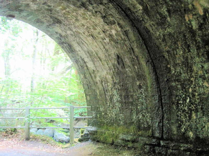
Entry Name: Taff Vale Railway bridge over Cwm Clydach (partly in Abercynon Community)
Listing Date: 12 December 2002
Last Amended: 8 April 2003
Grade: II
Source: Cadw
Source ID: 81031
ID on this website: 300081031
Location: On the very S boundary of Abercynon community and SE boundary of Ynysybwl and Coed y Cwm community, at the junction of Cwm Clydach with Taff Vale.
County: Rhondda Cynon Taff
Community: Ynysybwl and Coed-y-cwm (Ynys-y-bŵl a Choed-y-cwm)
Community: Pontypridd
Locality: Glyncoch
Traditional County: Glamorgan
See Record Number 80764 in Abercynon Community for full description of this bridge.
External links are from the relevant listing authority and, where applicable, Wikidata. Wikidata IDs may be related buildings as well as this specific building. If you want to add or update a link, you will need to do so by editing the Wikidata entry.


Other nearby listed buildings