Approximate Location Map
Large Map »
Latitude: 51.3994 / 51°23'57"N
Longitude: -3.3701 / 3°22'12"W
OS Eastings: 304782
OS Northings: 167594
OS Grid: ST047675
Mapcode National: GBR HP.R10G
Mapcode Global: VH6FP.J3Q2
Plus Code: 9C3R9JXH+PX
Entry Name: Walls surrounding Fonmon Pond including the Bridge and Weir and Well at Fonmon
Listing Date: 30 September 2004
Last Amended: 30 September 2004
Grade: II
Source: Cadw
Source ID: 83165
Building Class: Water Supply and Drainage
ID on this website: 300083165
Location: In the centre of Fonmon village.
County: Vale of Glamorgan
Town: Barry
Community: Rhoose (Y Rhws)
Community: Rhoose
Locality: Fonmon
Traditional County: Glamorgan
Tagged with: Bridge Road bridge
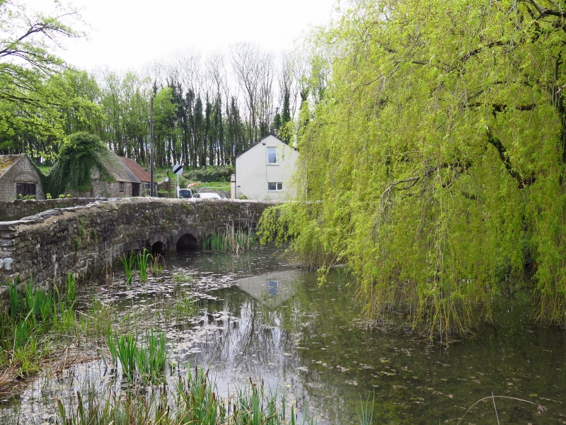
Likely to have been constructed mainly in the first half of the C19.
The brook at Fonmon has been impounded into a pond by the construction of a weir on the north side and a bridge over the stream entry on the south side, the pond being further edged by a low stone wall on the east and west sides. These are built of all, more or less coursed, local rubblestone. The bridge has a low hump and splayed walls with rounded coping and two small arches. The weir has an overflow between walls stepped up and back on either side. On the west side, up against the pond, is a covered well or dipping place for water supply purposes and there is another roofed well on the other side of the road, which is included separately. The scene is a curious one in that the water flows north and directly away from the nearby sea; passing Fonmon Castle the brook then veers to the west and joins the river Thaw.
Included as an unusual and extremely attractive construction for the local water supply.
External links are from the relevant listing authority and, where applicable, Wikidata. Wikidata IDs may be related buildings as well as this specific building. If you want to add or update a link, you will need to do so by editing the Wikidata entry.


Other nearby listed buildings
