Latitude: 53.8014 / 53°48'4"N
Longitude: -2.2372 / 2°14'13"W
OS Eastings: 384475
OS Northings: 433920
OS Grid: SD844339
Mapcode National: GBR DSTH.G2
Mapcode Global: WHB7X.LQW5
Plus Code: 9C5VRQ27+G4
Entry Name: Former Angle Street Baptist Church and Attached Forecourt Railings, Piers and Gates
Listing Date: 19 November 1997
Grade: II
Source: Historic England
Source ID: 1022607
English Heritage Legacy ID: 466977
ID on this website: 101022607
Location: Burnley Lane, Burnley, Lancashire, BB10
County: Lancashire
District: Burnley
Electoral Ward/Division: Daneshouse with Stoneyholme
Parish: Non Civil Parish
Built-Up Area: Burnley
Traditional County: Lancashire
Lieutenancy Area (Ceremonial County): Lancashire
Church of England Parish: Burnley St Andrew with St Margaret
Church of England Diocese: Blackburn
Tagged with: Building
BURNLEY
SD83SW ANGLE STREET 906-1/3/4 (West side) Former Angle Street Baptist Church & attached forecourt railings, piers & gates
GV II
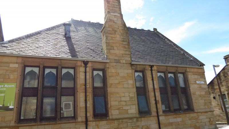
Baptist church now Islamic school, with attached forecourt railings and gate piers. Dated 1877 on 1st-floor band; altered. Sandstone ashlar, slate roof. Debased Romanesque style. Rectangular plan on triangular site, set back facing the angle. EXTERIOR: 2 storeys, a gabled 3-bay facade (1:3:1 windows), symmetrical, with a chamfered plinth, rusticated quoins to the corners and both sides of the outer bays at 1st floor, a broad band between floors now mostly plain but with raised lettering "1877" towards the right-hand end, and an open pedimental gable with a plain frieze over the outer bays and moulded coping. The centre has a pair of round-headed doorways at ground floor with squat set-in colonnettes which have crocket caps, semicircular overlights, horseshoe hood-moulds with foliated stops, and panelled double doors, and at 1st floor a large round-headed window with 2 round-headed lights and rose tracery in the head, flanked by narrow round-headed windows, with linked hood-moulds; each of the outer bays has a stair window of 3 staggered round-headed lights at ground floor, and a narrow round-headed window above, with circular tracery. The 6-window side walls have square-headed windows at ground floor, round-headed above, and stone gutter brackets. INTERIOR remodelled: former gallery removed, upper floor inserted and ground floor partitioned. SUBSIDIARY FEATURES: the triangular forecourt is enclosed by spear-headed bar railings mounted on a low stone wall with chamfered coping, and in the east side 2 pairs of gate piers with pyramidal tops and ramped iron gates. Forms group with associated former school (now Jamia Mosque) on North Street (qv) to which it is now linked at the rear, and a striking feature at the junction of 2 side streets otherwise lined with standardised terraced housing.
Listing NGR: SD8447533920
External links are from the relevant listing authority and, where applicable, Wikidata. Wikidata IDs may be related buildings as well as this specific building. If you want to add or update a link, you will need to do so by editing the Wikidata entry.


Other nearby listed buildings