Latitude: 53.8015 / 53°48'5"N
Longitude: -2.2359 / 2°14'9"W
OS Eastings: 384557
OS Northings: 433940
OS Grid: SD845339
Mapcode National: GBR DSTH.Q0
Mapcode Global: WHB7X.MQG1
Plus Code: 9C5VRQ27+JJ
Entry Name: Duke of York Hotel
Listing Date: 19 November 1997
Grade: II
Source: Historic England
Source ID: 1270966
English Heritage Legacy ID: 467039
ID on this website: 101270966
Location: Burnley Lane, Burnley, Lancashire, BB10
County: Lancashire
District: Burnley
Electoral Ward/Division: Bank Hall
Parish: Non Civil Parish
Built-Up Area: Burnley
Traditional County: Lancashire
Lieutenancy Area (Ceremonial County): Lancashire
Church of England Parish: Burnley St Andrew with St Margaret
Church of England Diocese: Blackburn
Tagged with: Hotel Pub Residential building
BURNLEY
SD83SW COLNE ROAD 906-1/3/47 (East side) No.129 Duke of York Hotel
GV II
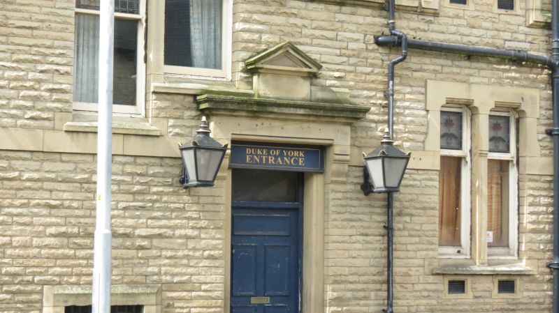
Hotel, now public house. Dated 1888 at 1st floor of west side; altered. Coursed sandstone rubble with freestone dressings, Cumberland slate roof. Jacobean style. Triangular plan on acutely-angled corner site at junction of Colne Road and Briercliffe Road. EXTERIOR: 3 and 2 storeys over cellars, 6:3 windows respectively plus a canted bay at the angled south end of the 2-storey portion; with a plinth, moulded sillband and impost band to 1st floor, plain frieze, moulded cornice and plain parapet (except the 2-storey portion which has no parapet). The 5th bay of the main range has a large doorway in an architrave composed of coupled pilasters with tall moulded consoles and a dentilled cornice, above this a sunk panel with raised lettering "DUKE OF YORK", a cross-window at 1st floor with an enriched pilastered architrave and panelled crest inscribed "1888", and a sashed window at 2nd floor breaking the cornice; the 2nd bay has a shallow 3-light oriel at 1st floor; most other windows are 2-light sashes with moulded surrounds and mullions, those at ground floor with shouldered lights and simplified cornices on consoles, those at 1st floor with stilted heads and moulded cornices and those at 2nd floor with raised sills on moulded brackets. Ridge chimney and gable chimneys. The 2-storey 3-window portion to the right has a large tripartite architrave to windows of 2, 2 and one light at ground floor, with pilasters and elongated consoles to a cornice; at 1st floor an oriel with a moulded corbel, flanked by single-light sashes; and at the south end a 2-storey canted bay which has a clockface in a carved surround set in the upper half of the central 1st-floor window. All these sashed windows have square upper leaves, mostly retaining intricate geometrical stained glass. Rear (to Briercliffe Road) similar but simpler, including doorways to both portions and staggered stair windows. INTERIOR altered. Forms a striking feature of the streetscape at this junction, and groups with Church of St Andrew to the north (qv).
Listing NGR: SD8455733940
External links are from the relevant listing authority and, where applicable, Wikidata. Wikidata IDs may be related buildings as well as this specific building. If you want to add or update a link, you will need to do so by editing the Wikidata entry.


Other nearby listed buildings