Approximate Location Map
Large Map »
Latitude: 51.6395 / 51°38'22"N
Longitude: -1.8416 / 1°50'29"W
OS Eastings: 411055
OS Northings: 193426
OS Grid: SU110934
Mapcode National: GBR 3S2.37H
Mapcode Global: VHB36.118Y
Plus Code: 9C3WJ5Q5+R8
Entry Name: Calcutt Court Farmhouse
Listing Date: 17 April 1986
Grade: II
Source: Historic England
Source ID: 1023088
English Heritage Legacy ID: 317747
ID on this website: 101023088
Location: Calcutt, Wiltshire, SN6
County: Wiltshire
Civil Parish: Cricklade
Traditional County: Wiltshire
Lieutenancy Area (Ceremonial County): Wiltshire
Church of England Parish: Cricklade
Church of England Diocese: Bristol
Tagged with: Farmhouse
SU 19 SW CRICKLADE CALCUTT
(west side)
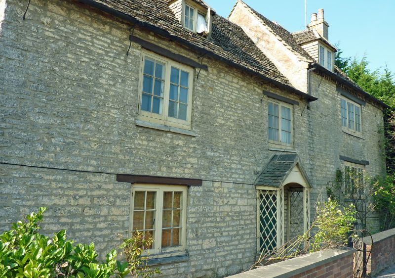
13/98 Calcutt Court Farmhouse
II
Farmhouse. C18. Coursed limestone rubble. Stone slate roof. Two
storey, 3 bays, the right bay a rebuild or extension with attic and
cellar. Six-panel door in simple porch. Paned casement windows
with bar stopped chamfered timber lintels. Gable stacks and 2
hipped dormers. Right bay has brick dentilled eaves and quoined
rear 2-storey extension with gable stack. Roof of this extension
carried down over porch in rear re-entrant angle.
Listing NGR: SU1105593426
External links are from the relevant listing authority and, where applicable, Wikidata. Wikidata IDs may be related buildings as well as this specific building. If you want to add or update a link, you will need to do so by editing the Wikidata entry.


Other nearby listed buildings
