Approximate Location Map
Large Map »
Latitude: 51.2335 / 51°14'0"N
Longitude: -0.3286 / 0°19'43"W
OS Eastings: 516784
OS Northings: 149587
OS Grid: TQ167495
Mapcode National: GBR HGJ.MQ1
Mapcode Global: VHGS7.8836
Plus Code: 9C3X6MMC+CG
Entry Name: Iron Railings and Gate Within Curtilage of No 227
Listing Date: 11 June 1973
Grade: II
Source: Historic England
Source ID: 1028871
English Heritage Legacy ID: 289938
ID on this website: 101028871
Location: Dorking, Mole Valley, Surrey, RH4
County: Surrey
District: Mole Valley
Electoral Ward/Division: Dorking North
Parish: Non Civil Parish
Built-Up Area: Dorking
Traditional County: Surrey
Lieutenancy Area (Ceremonial County): Surrey
Church of England Parish: Dorking St Martin
Church of England Diocese: Guildford
Tagged with: Guard rail
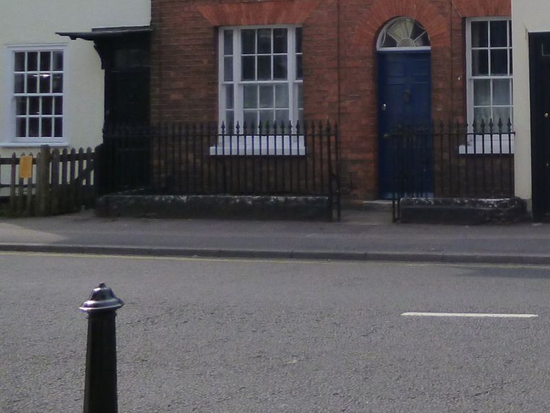
HIGH STREET
1.
1049
(North-West Side)
Iron railings and
gate within curtilage
of No 227
TQ 1649 NE 2/19A
II
2.
Iron railings and gate within curtilage of No 227. Photographs in NMR.
Listing NGR: TQ1678449587
External links are from the relevant listing authority and, where applicable, Wikidata. Wikidata IDs may be related buildings as well as this specific building. If you want to add or update a link, you will need to do so by editing the Wikidata entry.


Other nearby listed buildings
