Approximate Location Map
Large Map »
Latitude: 51.2336 / 51°14'0"N
Longitude: -0.3286 / 0°19'43"W
OS Eastings: 516784
OS Northings: 149593
OS Grid: TQ167495
Mapcode National: GBR HGJ.MQ0
Mapcode Global: VHGS7.8835
Plus Code: 9C3X6MMC+CG
Entry Name: 225-231, High Street
Listing Date: 11 June 1973
Grade: II
Source: Historic England
Source ID: 1228411
English Heritage Legacy ID: 289937
ID on this website: 101228411
Location: Dorking, Mole Valley, Surrey, RH4
County: Surrey
District: Mole Valley
Electoral Ward/Division: Dorking North
Parish: Non Civil Parish
Built-Up Area: Dorking
Traditional County: Surrey
Lieutenancy Area (Ceremonial County): Surrey
Church of England Parish: Dorking St Martin
Church of England Diocese: Guildford
Tagged with: Building
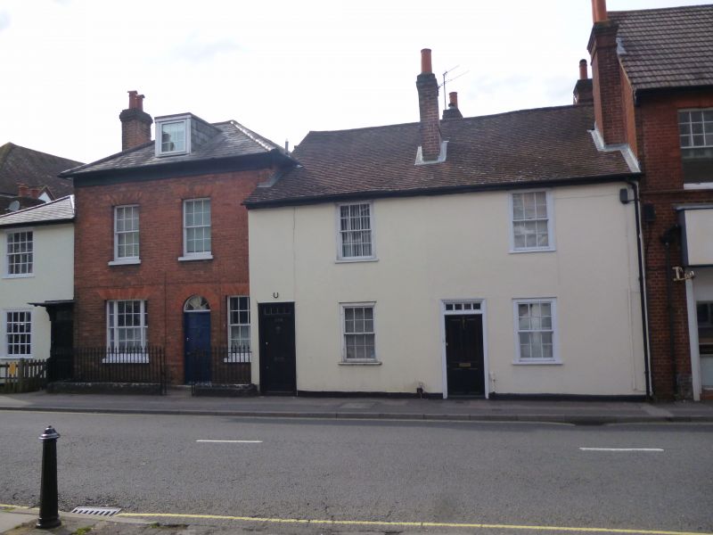
HIGH STREET
1.
1049
(North-West Side)
Nos 225 to 231 (odd)
TQ 1649 NE 2/19
II
2.
A group of 4 early C19 houses. 2 storeys, (No 227 with an attic storey and
one dormer) 5 windows in all. Stuccoed. (No 227 red brick). Eaves cornice,
Nos 225 and 227 have slate roofs, Nos 229 and 231 tiled roofs. Glazing bars
intact. Doorways with rectangular fanlights (No 227 has a semi-circular
one). No 225 has a flat hood over the doorway supported on brackets.
Listing NGR: TQ1677549590
External links are from the relevant listing authority and, where applicable, Wikidata. Wikidata IDs may be related buildings as well as this specific building. If you want to add or update a link, you will need to do so by editing the Wikidata entry.


Other nearby listed buildings
