Approximate Location Map
Large Map »
Latitude: 52.2471 / 52°14'49"N
Longitude: 0.7225 / 0°43'20"E
OS Eastings: 585954
OS Northings: 264479
OS Grid: TL859644
Mapcode National: GBR QF0.3GS
Mapcode Global: VHKD4.GST8
Plus Code: 9F426PWC+RX
Entry Name: 1-6, the Vinefields
Listing Date: 12 July 1972
Grade: II
Source: Historic England
Source ID: 1038278
English Heritage Legacy ID: 467593
ID on this website: 101038278
Location: Bury St Edmunds, West Suffolk, IP33
County: Suffolk
District: West Suffolk
Civil Parish: Bury St Edmunds
Built-Up Area: Bury St Edmunds
Traditional County: Suffolk
Lieutenancy Area (Ceremonial County): Suffolk
Church of England Parish: St James Bury St Edmunds
Church of England Diocese: St.Edmundsbury and Ipswich
Tagged with: Building
BURY ST EDMUNDS
TL8564SE THE VINEFIELDS
639-1/8/642 (East side)
12/07/72 Nos.1-6 (Consecutive)
GV II
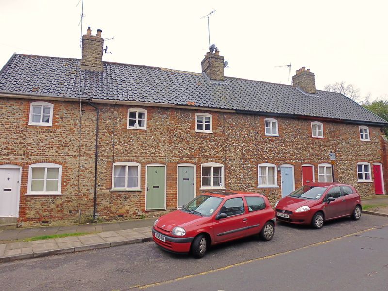
A row of 6 cottages. 1834. In flint and red brick with
pantiled roofs. 3 plain internal white brick chimney-stacks,
each topped by 6 chimney-pots. 2 storeys. 6 window range:
2-light sliding sashes with segmental-arched heads to frames
and a single glazing-bar to lights. 6 boarded doors with
vertical applied battens in plain segmental-arched surrounds.
A date panel in the south gable wall reads: 'F.& F.CLARK
1834'. This is a completely unaltered row.
INTERIOR: not inspected.
Listing NGR: TL8595464479
External links are from the relevant listing authority and, where applicable, Wikidata. Wikidata IDs may be related buildings as well as this specific building. If you want to add or update a link, you will need to do so by editing the Wikidata entry.


Other nearby listed buildings
