Latitude: 52.807 / 52°48'25"N
Longitude: -1.6422 / 1°38'32"W
OS Eastings: 424214
OS Northings: 323334
OS Grid: SK242233
Mapcode National: GBR 5DV.5LP
Mapcode Global: WHCG5.RP5Y
Plus Code: 9C4WR945+R4
Entry Name: Former Midland Railway Grain Warehouse Number 2
Listing Date: 22 June 1979
Grade: II
Source: Historic England
Source ID: 1038724
English Heritage Legacy ID: 272954
ID on this website: 101038724
Location: Burton upon Trent, East Staffordshire, DE14
County: Staffordshire
District: East Staffordshire
Civil Parish: Shobnall
Built-Up Area: Burton upon Trent
Traditional County: Staffordshire
Lieutenancy Area (Ceremonial County): Staffordshire
Church of England Parish: Burton St Aidan and St Paul
Church of England Diocese: Lichfield
Tagged with: Goods shed Former warehouse
DERBY STREET 1. 5369 Former Midland Railway Grain Warehouse No 2 SK 22 SW 6/134
II
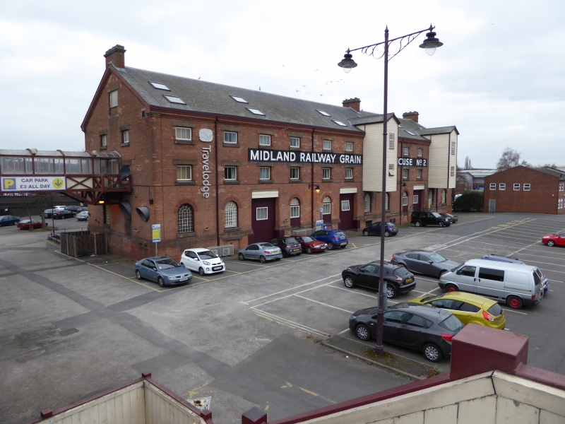
2. Circa 1880-90 former grain warehouse. 3 storeys and basement built of red brick with the quality of detailing and restrained architectural dressing associated with the Midland Railway. 11 bays long with round headed ground floor windows, finely gauged brick arches and fixed iron glazing bars. Upper floors have square windows with ashlar lintels, centre pivot small pane iron lights. Moulded brick eaves cornice to gable end slate roof with range of skylights. Corniced chimneys to gable ends and off centre. 2 weatherboarded, gabled 2-storey grain hoists face the railway and a similar one on the north side faces the yard. The warehouse is located close to the brewery complex along Station Street.
Listing NGR: SK2421423333
External links are from the relevant listing authority and, where applicable, Wikidata. Wikidata IDs may be related buildings as well as this specific building. If you want to add or update a link, you will need to do so by editing the Wikidata entry.


Other nearby listed buildings