Approximate Location Map
Large Map »
Latitude: 51.3592 / 51°21'33"N
Longitude: 0.0669 / 0°4'0"E
OS Eastings: 544002
OS Northings: 164261
OS Grid: TQ440642
Mapcode National: GBR NT.3KB
Mapcode Global: VHHPB.33QD
Plus Code: 9F329358+MP
Entry Name: 38, High Street
Listing Date: 29 June 1973
Grade: II
Source: Historic England
Source ID: 1040038
English Heritage Legacy ID: 358478
ID on this website: 101040038
Location: Farnborough, Bromley, London, BR6
County: London
District: Bromley
Electoral Ward/Division: Farnborough and Crofton
Parish: Non Civil Parish
Built-Up Area: Bromley
Traditional County: Kent
Lieutenancy Area (Ceremonial County): Greater London
Church of England Parish: Farnborough St Giles
Church of England Diocese: Rochester
Tagged with: Building
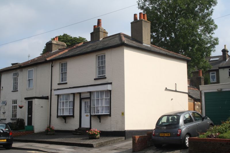
HIGH STREET, FARNBOROUGH
1. (South Side)
4407
No 38
TQ 46 SW 12/271
II
2.
Early to mid Cl9. 2 storeys painted brick. Hipped slate roof. 2 sashes with
glazing bars intact. Ground floor has 2 curved bows and a simple doorcase between
with rectangular fanlight.
Listing NGR: TQ4400464260
External links are from the relevant listing authority and, where applicable, Wikidata. Wikidata IDs may be related buildings as well as this specific building. If you want to add or update a link, you will need to do so by editing the Wikidata entry.


Other nearby listed buildings
