Approximate Location Map
Large Map »
Latitude: 51.359 / 51°21'32"N
Longitude: 0.0717 / 0°4'18"E
OS Eastings: 544341
OS Northings: 164252
OS Grid: TQ443642
Mapcode National: GBR NT.4RZ
Mapcode Global: VHHPB.638J
Plus Code: 9F32935C+JM
Entry Name: 5, Church Road
Listing Date: 29 June 1973
Grade: II
Source: Historic England
Source ID: 1064341
English Heritage Legacy ID: 358405
ID on this website: 101064341
Location: Farnborough, Bromley, London, BR6
County: London
District: Bromley
Electoral Ward/Division: Farnborough and Crofton
Parish: Non Civil Parish
Built-Up Area: Bromley
Traditional County: Kent
Lieutenancy Area (Ceremonial County): Greater London
Church of England Parish: Farnborough St Giles
Church of England Diocese: Rochester
Tagged with: Building
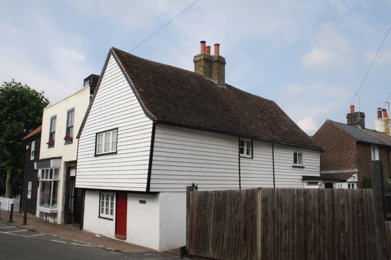
1. CHURCH ROAD, FARNBOROUGH
4407 (North-West Side)
No 5
TQ 46 SW 12/165
II GV
2.
Early C18. 2 storeys. 1st floor overhangs and is weatherboarded. Ground
floor stuccoed. Gable front. 1-3 light window on front elevation. C19
panelled door. The side elevation has 2 casement windows. Tiled roof.
Modern porch.
No 3 and 5 form a group.
Listing NGR: TQ3916068890
External links are from the relevant listing authority and, where applicable, Wikidata. Wikidata IDs may be related buildings as well as this specific building. If you want to add or update a link, you will need to do so by editing the Wikidata entry.


Other nearby listed buildings
