Approximate Location Map
Large Map »
Latitude: 51.1829 / 51°10'58"N
Longitude: -3.446 / 3°26'45"W
OS Eastings: 299026
OS Northings: 143625
OS Grid: SS990436
Mapcode National: GBR LK.5QT2
Mapcode Global: VH6GM.7J2J
Plus Code: 9C3R5HM3+5H
Entry Name: J H Parham's General Store
Listing Date: 22 May 1969
Grade: II
Source: Historic England
Source ID: 1057603
English Heritage Legacy ID: 264663
ID on this website: 101057603
Location: Dunster, Somerset, TA24
County: Somerset
District: Somerset West and Taunton
Civil Parish: Dunster
Built-Up Area: Dunster
Traditional County: Somerset
Lieutenancy Area (Ceremonial County): Somerset
Tagged with: Building
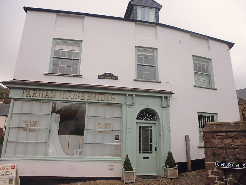
1.
5366 DUNSTER CHURCH STREET
SS 9843-9943 4/31 22.5.69 No 22 (J H Parham's General Store)
II GV
2.
Early 19th century. Colourwashed render, hipped slate roof, eaves. Two storeys plus
attics. Three windows (attic window blocked), sashes with glazing bars, exposed
frames. Coeval shop front and entrance to ground floor left-hand, small panes with
glazing bars. Semi-circular headed right-hand door opening, arched fanlight.
Listing NGR: SS9902943625
External links are from the relevant listing authority and, where applicable, Wikidata. Wikidata IDs may be related buildings as well as this specific building. If you want to add or update a link, you will need to do so by editing the Wikidata entry.


Other nearby listed buildings
