Latitude: 51.1829 / 51°10'58"N
Longitude: -3.4463 / 3°26'46"W
OS Eastings: 299011
OS Northings: 143620
OS Grid: SS990436
Mapcode National: GBR LK.5QS0
Mapcode Global: VH6GM.6JYK
Plus Code: 9C3R5HM3+4F
Entry Name: 24, Church Street
Listing Date: 4 August 1983
Grade: II
Source: Historic England
Source ID: 1345611
English Heritage Legacy ID: 264664
ID on this website: 101345611
Location: Dunster, Somerset, TA24
County: Somerset
District: Somerset West and Taunton
Civil Parish: Dunster
Built-Up Area: Dunster
Traditional County: Somerset
Lieutenancy Area (Ceremonial County): Somerset
Tagged with: Building
1. 5366 DUNSTER CHURCH STREET
No 24 SS 9843-9943 4/32
II GV
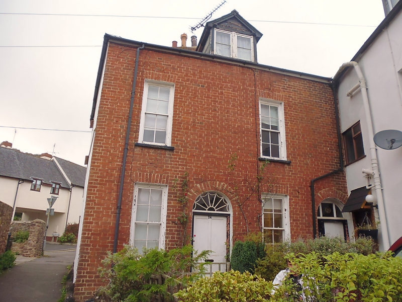
2. Early 19th century. Brick front, render to side elevation. Hipped slate roof. Two storeys plus attics. Dormer window, gable casement window. Four narrow sash windows, glazing bars, flat arch voussoirs. Central panelled door, semi-circular fanlight with tracery. Plain doorway to right with semi-circular arch.
Listing NGR: SS9901143619
External links are from the relevant listing authority and, where applicable, Wikidata. Wikidata IDs may be related buildings as well as this specific building. If you want to add or update a link, you will need to do so by editing the Wikidata entry.


Other nearby listed buildings