Latitude: 51.3714 / 51°22'16"N
Longitude: -0.0067 / 0°0'24"W
OS Eastings: 538840
OS Northings: 165475
OS Grid: TQ388654
Mapcode National: GBR L8.8ZP
Mapcode Global: VHGRM.TSSL
Plus Code: 9C3X9XCV+G8
Entry Name: Glebe House
Listing Date: 28 May 1954
Grade: II
Source: Historic England
Source ID: 1068833
English Heritage Legacy ID: 358414
ID on this website: 101068833
Location: West Wickham, Bromley, London, BR4
County: London
District: Bromley
Electoral Ward/Division: West Wickham
Parish: Non Civil Parish
Built-Up Area: Bromley
Traditional County: Kent
Lieutenancy Area (Ceremonial County): Greater London
Church of England Parish: West Wickham St John
Church of England Diocese: Southwark
Tagged with: House
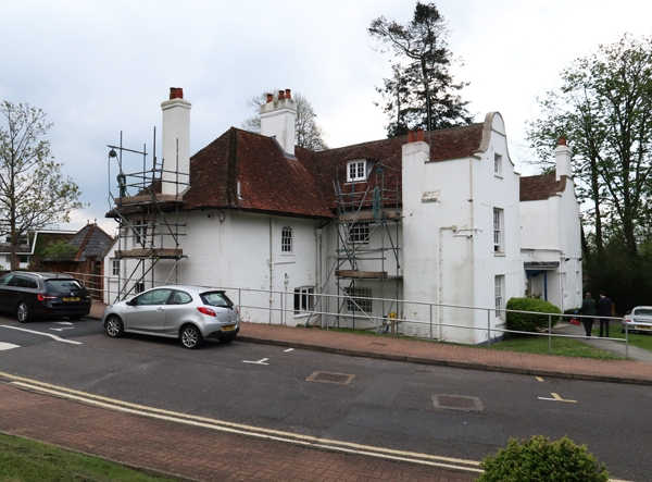
CORKSCREW HILL
1.
4407 WEST WICKHAM
No 42 (Glebe House)
TQ 36 NE 2/21 28.5.54.
II
2.
C1 8house formerly West Wickham Rectory. Stuccoed. 2 storeys 5 windows.
Glazing bars intact. Cornice and parapet. The house is of half-H plan
with shaped gables to the wings and the portion between filled in on ground
floor only.
Listing NGR: TQ3884065475
External links are from the relevant listing authority and, where applicable, Wikidata. Wikidata IDs may be related buildings as well as this specific building. If you want to add or update a link, you will need to do so by editing the Wikidata entry.


Other nearby listed buildings