Approximate Location Map
Large Map »
Latitude: 51.2697 / 51°16'10"N
Longitude: 0.3063 / 0°18'22"E
OS Eastings: 560983
OS Northings: 154805
OS Grid: TQ609548
Mapcode National: GBR NPM.68G
Mapcode Global: VHHPV.8C80
Plus Code: 9F327894+VG
Entry Name: Buttons Bourne Farmhouse
Listing Date: 3 May 1984
Grade: II
Source: Historic England
Source ID: 1072682
English Heritage Legacy ID: 357327
ID on this website: 101072682
Location: Claygate Cross, Tonbridge and Malling, Kent, TN15
County: Kent
District: Tonbridge and Malling
Civil Parish: Plaxtol
Traditional County: Kent
Lieutenancy Area (Ceremonial County): Kent
Church of England Parish: Plaxtol
Church of England Diocese: Rochester
Tagged with: Farmhouse
TQ 65 SW PLAXTOL BOURNE LANE
4/9 (south side)
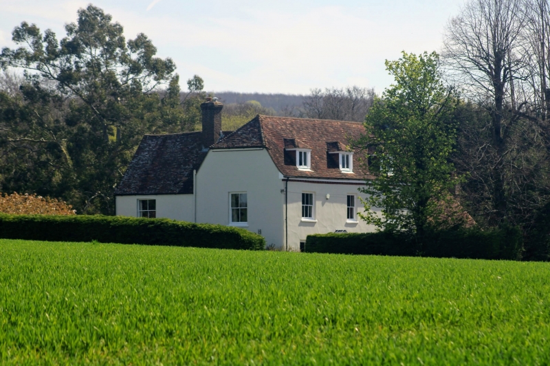
Buttons Bourne
Farmhouse
II
Farmhouse. Late C18. Painted brick on wide plinth. Corbelled boxed eaves to plain
tiled roof, half-hipped to north, with 3 sliding casement hipped dormers. Two storeys
with attic and cellar; 3 windows, glazing bar sashes. One half collar light. Central
panelled door with modern porch.
Listing NGR: TQ6098354805
External links are from the relevant listing authority and, where applicable, Wikidata. Wikidata IDs may be related buildings as well as this specific building. If you want to add or update a link, you will need to do so by editing the Wikidata entry.


Other nearby listed buildings
