Latitude: 52.2464 / 52°14'47"N
Longitude: 0.713 / 0°42'46"E
OS Eastings: 585310
OS Northings: 264386
OS Grid: TL853643
Mapcode National: GBR QF0.12Y
Mapcode Global: VHKD4.9STR
Plus Code: 9F426PW7+H6
Entry Name: Number 42 (East Half)
Listing Date: 18 December 1989
Grade: II
Source: Historic England
Source ID: 1076924
English Heritage Legacy ID: 466758
ID on this website: 101076924
Location: Bury St Edmunds, West Suffolk, IP33
County: Suffolk
District: West Suffolk
Civil Parish: Bury St Edmunds
Built-Up Area: Bury St Edmunds
Traditional County: Suffolk
Lieutenancy Area (Ceremonial County): Suffolk
Church of England Parish: Bury St Edmunds St John the Evangelist
Church of England Diocese: St.Edmundsbury and Ipswich
Tagged with: Building
BURY ST EDMUNDS
TL8564SW CORNHILL 639-1/7/288 (North side) 18/12/89 No.42 (East half)
GV II
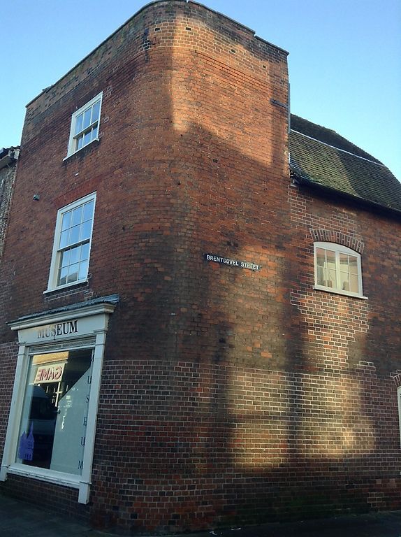
House and shop. Early C19, possibly with an older core. Red brick, laid in Flemish bond; plaintiled mansard roof. EXTERIOR: 3 storeys. One window to each storey on the Cornhill frontage: C20 casements to the 1st storey with gauged brick arched surrounds; a late-C19 6-pane sash window to the 2nd storey. The ground storey has a plate-glass shop window with fluted pilasters, fascia and cornice to an early C19 architrave. An early C20 half-glazed door to the left, with a rectangular fanlight, set in an early C20 moulded wood architrave. The return front to Brentgovel Street has a segmental brick arch over the C20 first storey casement window and a C20 shop window on the ground storey. INTERIOR: incorporates remains of the early C16 east bay of No.42 (west half) (qv). Warren's map of 1747 marks the building on this site as 'the Hall'.
Listing NGR: TL8531064386
External links are from the relevant listing authority and, where applicable, Wikidata. Wikidata IDs may be related buildings as well as this specific building. If you want to add or update a link, you will need to do so by editing the Wikidata entry.


Other nearby listed buildings