Latitude: 51.5749 / 51°34'29"N
Longitude: 0.1754 / 0°10'31"E
OS Eastings: 550843
OS Northings: 188470
OS Grid: TQ508884
Mapcode National: GBR SK.DWR
Mapcode Global: VHHN7.0P21
Plus Code: 9F32H5FG+X5
Entry Name: Salem Chapel
Listing Date: 14 July 1979
Grade: II
Source: Historic England
Source ID: 1079900
English Heritage Legacy ID: 201599
ID on this website: 101079900
Location: Romford, Havering, London, RM7
County: London
District: Havering
Electoral Ward/Division: Romford Town
Parish: Non Civil Parish
Built-Up Area: Havering
Traditional County: Essex
Lieutenancy Area (Ceremonial County): Greater London
Church of England Parish: Romford St Andrew
Church of England Diocese: Chelmsford
Tagged with: Chapel
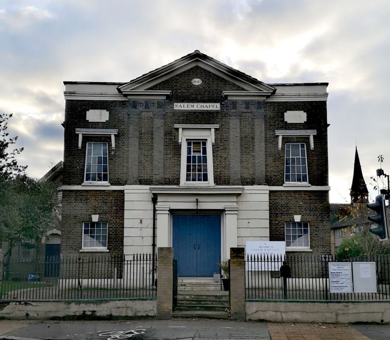
LONDON ROAD 1. 5107 Romford Salem Chapel TQ 5088/5188 5/8 II 2. 1847 (date plaque on building). Baptist Chapel; stock brick, principal elevation to London Road 3 bays wide 2 storeys high. Projecting central bay with stucco quoins to ground floor and wide central doorway with stucco pilasters: paired brick pilasters to upper floor with open pediment and central Egyptian window with stucco architrave. Flanking bays with small square windows to ground floor and Egyptian windows above with hoods on tapering brackets, plain stucco plaques over. Stucco parapet. Return elevation to St Andrews Road of 3 bays with segmental-headed windows in recessed panels. Original cast-iron railings, standards and gates by Wedlake Thompson of Hornchurch. Additional buildings include lecture room added in 1868, not of special irnterest.
Listing NGR: TQ5084388470
External links are from the relevant listing authority and, where applicable, Wikidata. Wikidata IDs may be related buildings as well as this specific building. If you want to add or update a link, you will need to do so by editing the Wikidata entry.


Other nearby listed buildings