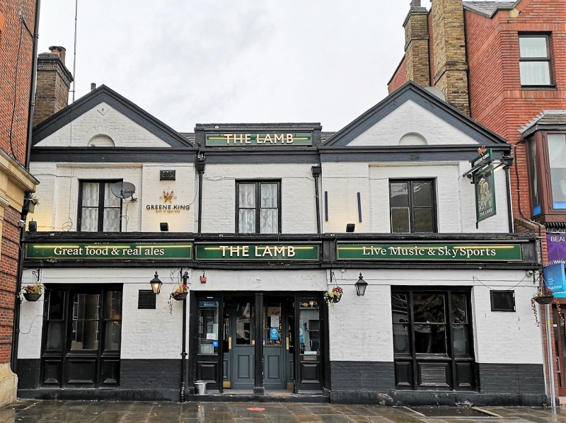
Latitude: 51.5787 / 51°34'43"N
Longitude: 0.1803 / 0°10'49"E
OS Eastings: 551171
OS Northings: 188905
OS Grid: TQ511889
Mapcode National: GBR SK.83B
Mapcode Global: VHHN7.2LN3
Plus Code: 9F32H5HJ+F4
Entry Name: The Lamb Public House
Listing Date: 14 September 1979
Grade: II
Source: Historic England
Source ID: 1183878
English Heritage Legacy ID: 201608
Also known as: Lamb
The Lamb, Romford
ID on this website: 101183878
Location: Romford, Havering, London, RM1
County: London
District: Havering
Electoral Ward/Division: Romford Town
Parish: Non Civil Parish
Built-Up Area: Havering
Traditional County: Essex
Lieutenancy Area (Ceremonial County): Greater London
Church of England Parish: Romford St Edward Confessor
Church of England Diocese: Chelmsford
Tagged with: Pub
MARKET PLACE 1. 5107 Romford No 5 (The Lamb Public House) TQ 5088/5188 5/4 II GV 2. Early to mid C19. Painted brick, modern tile roof. Two storeys central recess with parapet, pedimented side bays breaking forward. One-one-one 1st floor casements. Blind semi-circular openings in pediment tympana. Ground floor sashes, stucco entablature. Reeded pilasters with paterae to central door and windows.
Listing NGR: TQ5117188905
External links are from the relevant listing authority and, where applicable, Wikidata. Wikidata IDs may be related buildings as well as this specific building. If you want to add or update a link, you will need to do so by editing the Wikidata entry.


Other nearby listed buildings