Latitude: 51.5785 / 51°34'42"N
Longitude: 0.1801 / 0°10'48"E
OS Eastings: 551156
OS Northings: 188880
OS Grid: TQ511888
Mapcode National: GBR SK.82B
Mapcode Global: VHHN7.2LK8
Plus Code: 9F32H5HJ+C2
Entry Name: The Golden Lion the Golden Lion Public House
Listing Date: 14 September 1979
Grade: II
Source: Historic England
Source ID: 1358531
English Heritage Legacy ID: 201592
ID on this website: 101358531
Location: Romford, Havering, London, RM1
County: London
District: Havering
Electoral Ward/Division: Romford Town
Parish: Non Civil Parish
Built-Up Area: Havering
Traditional County: Essex
Lieutenancy Area (Ceremonial County): Greater London
Church of England Parish: Romford St Edward Confessor
Church of England Diocese: Chelmsford
Tagged with: Pub
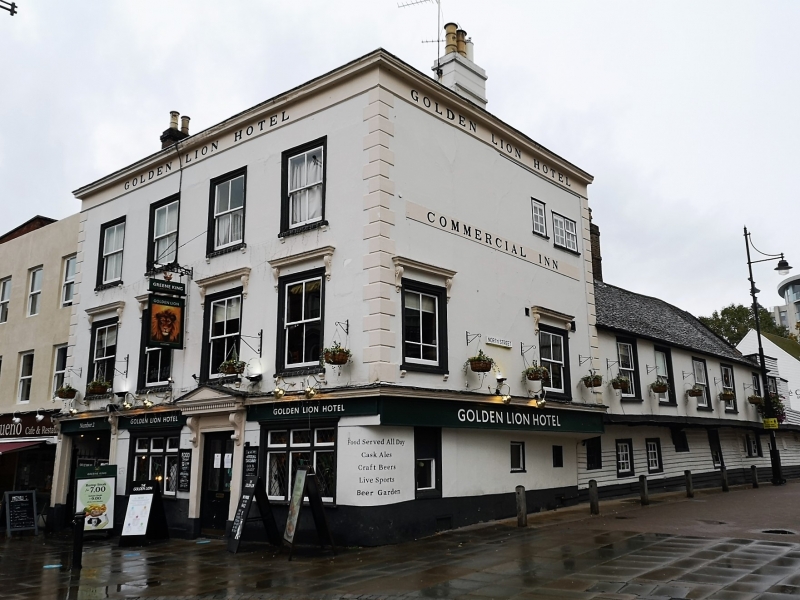
HIGH STREET 1. 5107 Romford No 2 (The Golden Lion Public House) TQ 5088/5188 5/5 II 2. Inn of various dates from the C17 onwards. Front to High Street late C18 or early C19; 3 storeys, 4 bays, rendered with stucco rusticated quoins; ground floor has carriage entrance on left hand side and C19 bar front with central doorway, pedimented door hood on scrolled brackets and moulded cornice. First floor with 4 flush sashes with moulded hoods on scrolled brackets; 2nd floor 4 sashes with moulded wooden frames. Cornice with fragment of parapet above. Old tile roof hipped at east. Front to North Street: return wall of High Street front jettied above ground floor, the jetty projecting further at the north than the south. Two sashes to 1st floor with architraves and 2 small modern windows to 2nd floor. Further north is a C17 or early C18 timber-framed building of 2 storeys with a jettied 1st floor. Brick plinth, ground floor partly weatherboarded, partly rendered with a variety of window openings. Rendered 1st floor with 5 sashes. Old tile roof with one stack through ridge. To the north are the remains of a further timber-framed range. In the angle between the High Street and North Street ranges is an early C19 brick addition of 3 storeys with hipped slate roof.
Listing NGR: TQ5115688880
External links are from the relevant listing authority and, where applicable, Wikidata. Wikidata IDs may be related buildings as well as this specific building. If you want to add or update a link, you will need to do so by editing the Wikidata entry.


Other nearby listed buildings