Latitude: 51.4455 / 51°26'43"N
Longitude: -0.1355 / 0°8'7"W
OS Eastings: 529668
OS Northings: 173481
OS Grid: TQ296734
Mapcode National: GBR FX.LHV
Mapcode Global: VHGR5.LXQS
Plus Code: 9C3XCVW7+5Q
Entry Name: 24, Thornton Road SW12
Listing Date: 29 June 1973
Grade: II
Source: Historic England
Source ID: 1081068
English Heritage Legacy ID: 204708
ID on this website: 101081068
Location: Poynders Parade, Lambeth, London, SW12
County: London
District: Lambeth
Electoral Ward/Division: Thornton
Parish: Non Civil Parish
Built-Up Area: Lambeth
Traditional County: Surrey
Lieutenancy Area (Ceremonial County): Greater London
Church of England Parish: Telford Park, St Thomas and St Stephen
Church of England Diocese: Southwark
Tagged with: Building
THORNTON ROAD SW12 1. (west side) 5023 --TH01+ON +-ROAD SWI 2 No 24 TQ 2973 25/955 29.6.73
II
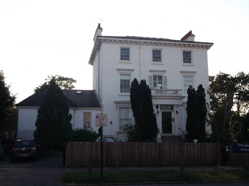
2. Substantial mid C19 villa built by Thomas Cubitt. Three storeys and basement, 3 windows. Low-pitched hipped slated roof has deep, modillioned eaves soffit above moulded cornice. Stucco. Moulded window architraves, those on first and ground floor with cornices. Ground floor cornices and projecting cills on console brackets. Sash windows with glazing bars (missing on ground floor) except first floor centre where long casement opens to balustraded balcony above prostyle Doric porch with square columns and filled sides. Four-panel door, flanked by pilasters, has rectangular fanlight holding glazed lampholder. Similar rear elevation has balustraded flight of steps to French door at left. Ground floor band. Blind-cases to ground floor.
Listing NGR: TQ2966873481
External links are from the relevant listing authority and, where applicable, Wikidata. Wikidata IDs may be related buildings as well as this specific building. If you want to add or update a link, you will need to do so by editing the Wikidata entry.


Other nearby listed buildings