Latitude: 52.1567 / 52°9'24"N
Longitude: -2.6879 / 2°41'16"W
OS Eastings: 353034
OS Northings: 251162
OS Grid: SO530511
Mapcode National: GBR FM.67VR
Mapcode Global: VH859.C1CZ
Plus Code: 9C4V5846+MR
Entry Name: Well Cottage
Listing Date: 21 May 1987
Grade: II
Source: Historic England
Source ID: 1082018
English Heritage Legacy ID: 149589
ID on this website: 101082018
Location: Bodenham, County of Herefordshire, HR1
County: County of Herefordshire
Civil Parish: Bodenham
Traditional County: Herefordshire
Lieutenancy Area (Ceremonial County): Herefordshire
Church of England Parish: Bodenham
Church of England Diocese: Hereford
Tagged with: Cottage
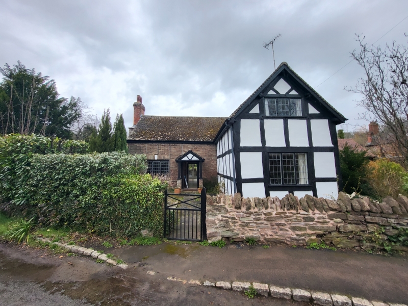
BODENHAM CP BODENHAM SO 55, SW 5/26 Well Cottage GV II House. C17 with mid-C19 and mid-C20 alterations. Part timber-framed with rendered infill on sandstone rubble base with some painted brick replacement walling, part dressed sandstone rubble; plain tiled roofs. L-plan; main range aligned east/west of three bays having large external rubble chimney with offsets and brick stack at west end. Wing of two bays adjoins eastern end of south elevation and has a C19 external rubble chimney with a brick stack on its east side. Single storey and attic. Framing: three rows of square panels from sill to wall-plate. Collar and tie-beam trusses with struts and V-struts in apex at east end and south end of wing. Part of a possible fishbone truss visible at west end. South front elevation: main part has a C20 bow window on the ground floor inserted in an opening with a flat arch and a moulded dropped keyblock. To the right of it is the main entrance which has a C20 timber-framed gabled porch with a tall rubble base and a C20 glazed door within. At the south end of the wing is a 3-light C20 leaded casement at ground floor and attic level. The building is not marked on the 1813 map. Dr Brian has noted that it is referred to as "late Jay's" and "formerly Jays" in the building records. Jay's Bank Farmhouse originally stood to the east of Bodenham Court Farmhouse (qv) and was re-erected on its present site some time after 1813. (RCHM Herefs II, p 15, item 11; Brian, Dr A: The Houses of the Township of Bodenham Devereux and their inhabitants in the C19 and earlier, unpublished notes).
Listing NGR: SO5303451162
External links are from the relevant listing authority and, where applicable, Wikidata. Wikidata IDs may be related buildings as well as this specific building. If you want to add or update a link, you will need to do so by editing the Wikidata entry.


Other nearby listed buildings