Approximate Location Map
Large Map »
Latitude: 51.2845 / 51°17'4"N
Longitude: 1.0707 / 1°4'14"E
OS Eastings: 614231
OS Northings: 158406
OS Grid: TR142584
Mapcode National: GBR TY2.FJK
Mapcode Global: VHLGF.HZX6
Plus Code: 9F3373MC+Q7
Entry Name: 4, Forty Acres Road
Listing Date: 7 September 1973
Grade: II
Source: Historic England
Source ID: 1085057
English Heritage Legacy ID: 170610
ID on this website: 101085057
Location: St Dunstan's, Canterbury, Kent, CT2
County: Kent
District: Canterbury
Electoral Ward/Division: St Stephen's
Parish: Non Civil Parish
Built-Up Area: Canterbury
Traditional County: Kent
Lieutenancy Area (Ceremonial County): Kent
Tagged with: Building
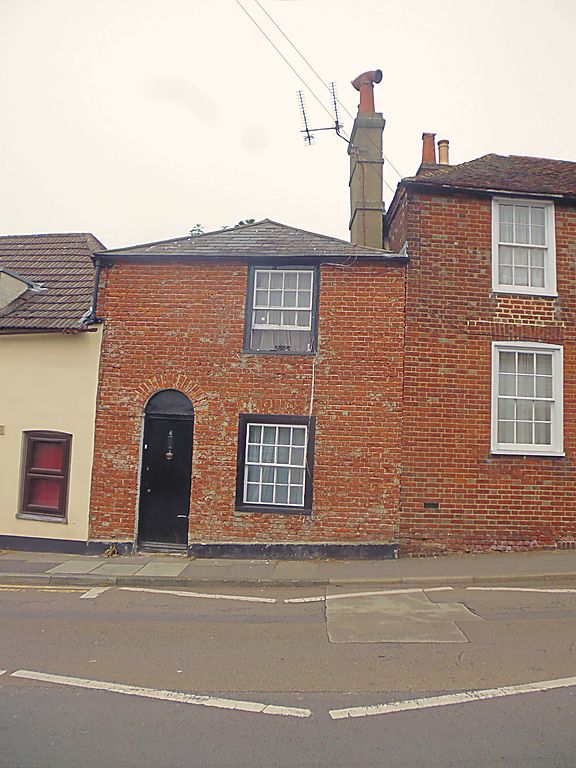
1.
944 FORTY ACRES ROAD
(South West Side)
TR 1458 SW 1/494 No 4
II GV
2.
Early C19. 2 storeys stuccoed. Hipped slate roof. 1 sash with glazing
bars intact. Left side doorcase with round-headed fanlight and 4 panelled door.
Nos 2, 4 & 5 form a group.
Listing NGR: TR1422958407
External links are from the relevant listing authority and, where applicable, Wikidata. Wikidata IDs may be related buildings as well as this specific building. If you want to add or update a link, you will need to do so by editing the Wikidata entry.


Other nearby listed buildings
