Latitude: 51.2844 / 51°17'3"N
Longitude: 1.0704 / 1°4'13"E
OS Eastings: 614210
OS Northings: 158399
OS Grid: TR142583
Mapcode National: GBR TY2.FF8
Mapcode Global: VHLGF.HZR7
Plus Code: 9F3373MC+Q5
Entry Name: 14 and 16, Whitstable Road
Listing Date: 7 September 1973
Grade: II
Source: Historic England
Source ID: 1259825
English Heritage Legacy ID: 443892
ID on this website: 101259825
Location: St Dunstan's, Canterbury, Kent, CT2
County: Kent
District: Canterbury
Electoral Ward/Division: St Stephen's
Parish: Non Civil Parish
Built-Up Area: Canterbury
Traditional County: Kent
Lieutenancy Area (Ceremonial County): Kent
Tagged with: Building
1. 944 WHITSTABLE ROAD (East Side)
Nos 14 and 16 TR 1458 SW 1/314
II GV
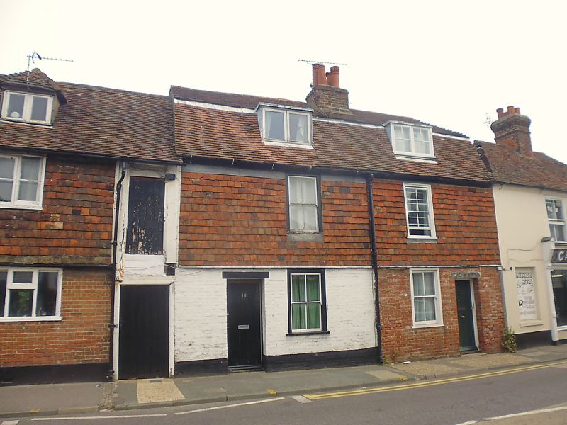
2. C18 pair. 2 storeys painted brick, tile-hung on 1st floor. Old tiled mansard roof with 2 dormers. 2 sashes with verticals only. Simple doorcases.
Nos 12 to 24 (even) form a group.
Listing NGR: TR1420858401
External links are from the relevant listing authority and, where applicable, Wikidata. Wikidata IDs may be related buildings as well as this specific building. If you want to add or update a link, you will need to do so by editing the Wikidata entry.


Other nearby listed buildings